
Rio Serpis Circuit from Vilallonga
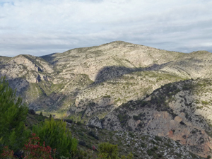
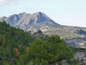
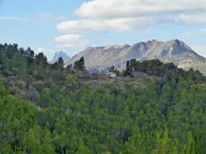
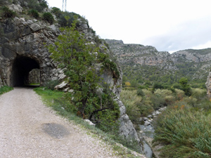
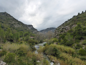
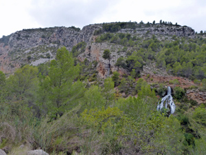
Circular route with a half an hour of road climbing to warm us up before following undulating paths with spectacular views to the old Hydro power station & lunch by the river. Return via the old railway line. Bring a torch if you do not like the dark. Sticks useful for some of the descents. Flowers in profusion in springtime.
Spanish maps included within these descriptions are provided courtesy of the Spanish IGN and remain © Instituto Geográfico Nacional.
OSM (OpenStreetMap) and OCM (OpenCycleMap) maps are © OpenStreetMap Contributors. The OSM project welcomes contributions from all to enrich the map data, which is made freely available. Land (Thunderforest Landscape) maps are © Thunderforest based on data © OpenStreetMap contributors.
The grade of this walk is MS/B, which means
MS – Moderately Strenuous: Up to 600 metres ascent and/or no more than 15 km in length with some rough going taken at a reasonable pace.
B – Less than half the route on rough ground
| Nearest town | Vilallonga |
| Directions to start |
Vilallonga. 38.888528 -0.216508. Arriving in Vilallonga using CV680, turn R at roundabout after filling station following direction towards Ador. N.B. Don’t turn to Ador before you get into the town or you have reached the filling station. At the second roundabout with a dog on the plinth – go straight ahead leaving the school on your left to Reprimala (along Via Pista). Pass the font & bar & continue up & round the bends to quarry. Park near information board 100 metres further on. |
| Start point (Lat/Long) | 38.875321, -0.243352 Click here to view in Google Maps (in a new browser tab) |
| Length (km) | 13.00 |
| Ascent (metres) | 500 |
| Walking time (hours) | 3.25 |
| Total time (hours) | 4.50 |
| Recommendations or Restrictions | Bring a torch for the tunnels and be careful on the descent to the old Hydro station as it can be a little slippy after rain. Walking sticks may be a help. |
Download walk descriptionDownload GPS file
This route is currently impassable as a landowner has blocked the path. Do not use until i update it
I walked this route on 20 April 2023. There is a “Private Property” sign close to the start in the Westerly direction. This was ignored by local dog-walkers, and this small section is easily bipassed by a parallel road anyway. On return, there is was no sign. This beautiful route is walkable.
From 38.86895, -027732 the path is very overgrown as it not often used.
At 38.87282, -0.26965 one option to pass through a private house garden might be OK if there is nobady at home but I would not take a group through there
At 38.87354, -0,2656 the landowner has made the gate impassable with a a wall, fence and barbed wire