
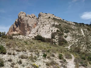
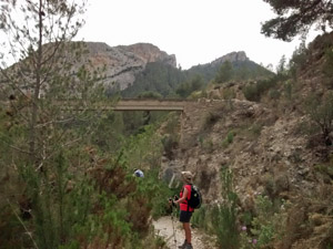
Maigmo circuit
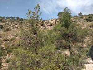
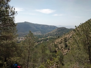
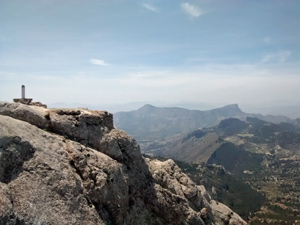
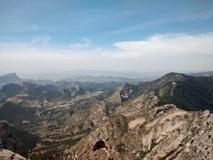
A circuit up to a rocky summit. After a leisurely start there’s a tough ascent to the first col. and on over the rocky and slightly exposed summit. Except for the summit the route is mostly on tracks and well defined paths with a short distance on quiet roads. Absolutely stunning views.
Spanish maps included within these descriptions are provided courtesy of the Spanish IGN and remain © Instituto Geográfico Nacional.
OSM (OpenStreetMap) and OCM (OpenCycleMap) maps are © OpenStreetMap Contributors. The OSM project welcomes contributions from all to enrich the map data, which is made freely available. Land (Thunderforest Landscape) maps are © Thunderforest based on data © OpenStreetMap contributors.
The grade of this walk is VS/B, which means
VS – Very Strenuous: More than 800 metres ascent and/or more than 20km in length with steep, loose or heavily vegetated sections.
B – Less than half the route on rough ground.
| Nearest town | Agost |
| Directions to start |
Travelling from Alicante to Alcoy on the A7 exit at junction 481 onto the CV827 to Agost. At approx. km 4.5 park on the hard-standing on the LHS of the road. |
| Start point (Lat/Long) | 38.478642, -0.638653 Click here to view in Google Maps (in a new browser tab) |
| Length (km) | 15.00 |
| Ascent (metres) | 870 |
| Walking time (hours) | 4.00 |
| Total time (hours) | 6.00 |
| Recommendations or Restrictions | Some minor scrambling to reach the top (avoidable) |
Download walk descriptionDownload GPS file
Hello,
I am interesting in doing this trail this summer and I still have some questions.
Is the circuit well indicated?
The level of the trail is said to be difficult. But is, besides good hiking shoes and well trained persons, some extra material required? Or is only the last part some scrambling? We do not want to be surprised during the hike!
If you have other recommondations about the trail, please let me know.
Thanks in advance for your response.
Kind regards,
Caroline Mossay