
Torre d’ Aguiló & Raco de Conil Circuit
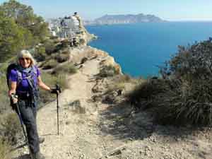
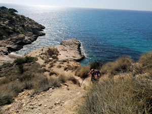
A short, scenic, circular walk along the clifftops and a more gentle return. Cliff paths are steep and have many loose stones. There is minor exposure.
Spanish maps included within these descriptions are provided courtesy of the Spanish IGN and remain © Instituto Geográfico Nacional.
OSM (OpenStreetMap) and OCM (OpenCycleMap) maps are © OpenStreetMap Contributors. The OSM project welcomes contributions from all to enrich the map data, which is made freely available. Land (Thunderforest Landscape) maps are © Thunderforest based on data © OpenStreetMap contributors.
The grade of this walk is M/B, which means
M – Moderate: up to 12km in length, less than 400 metres ascent and less than 50% rough going.
B – Less than half the route on rough ground
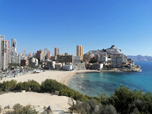
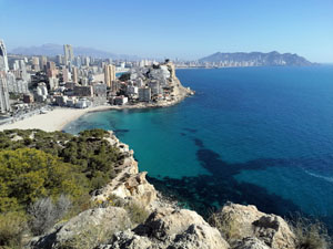
| Nearest town | Cala de Finestrat |
| Directions to start |
Start on seafront at Cala Finestrat. Parking is available on streets nearby, next to the beach and in a car park in front of supermarket Supercor Express. |
| Start point (Lat/Long) | 38.525326, -0.167157 Click here to view in Google Maps (in a new browser tab) |
| Length (km) | 5.00 |
| Ascent (metres) | 246 |
| Walking time (hours) | 2 |
| Total time (hours) | 2.5 |
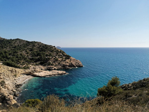
| Recommendations or Restrictions | Many loose stones on the steeper parts. Walking poles recommended. There is no source of water on this route. Swimming is possible at Raco de Conil. |
Download walk descriptionDownload GPS file
Mainly followed the GPS trace. Be warned the beach at Raco de Conil is popular with naturists. As you return through the “collection of abandoned houses”, these seem popular with male sex workers. We did not have a problem with them and they did not have a problem with us.