
The Canary Islands belong to Spain but lie a good deal south of mainland Spain and to the west of the coast of Africa! Given that they are in the middle of the Atlantic they can enjoy variable weather, but in general they are warmer than Europe and so have become a magnet for tourists. This means that the beach areas are nearly always buzzing with people but it is still possible to find considerably quieter areas inland.
All of these islands were at some point volcanic and if not entirely visible at sea level, then the volcanic history will soon become apparent as you climb towards their highest points.
In particular the island of Tenerife contains Spain’s highest peak El Teide – surpassing even those that lie within the Pyrenees and the second highest peak which sits in the Sierra Nevada, Mulhacen.
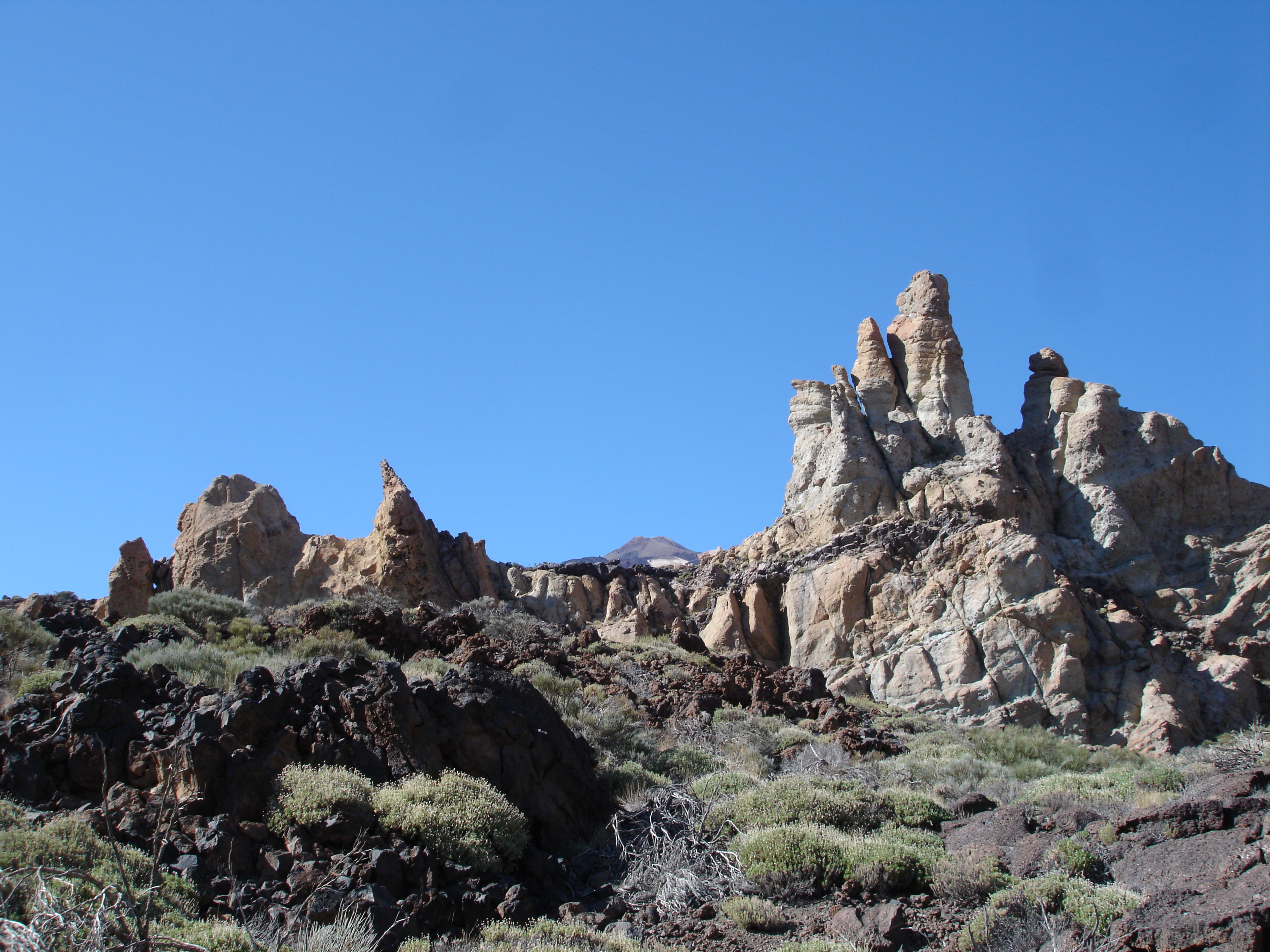
Rock Formations in Las Cañadas (Teide Crater)
The walking on Tenerife can be very interesting and those with a penchant for these things may want to scale the heights of Teide to say that they have visited the highest point in Spain. although you will need a permit to do so – here. The climate will change dramatically along the way even if the sun continues to shine on the coast. Frequently the middle belt of the island is clad in cloud or mist and then the peak rises majestically above this in clear blue skies.
From hot, hot hot at the coast the air temperature will descend rapidly and your exposure to the suns rays will be intensified as the air thins at higher altitudes. In addition you will probably feel at least the early effects of altitude even if these do not greatly slow you down.
Accommodation is generally easy to find but should be booked well in advance. Prices are higher than in mainland Spain. Flights run from both the UK and the mainland. There is an excellent bus service across the island (see titsa.com).
Walking Areas in Tenerife
Because of the prevailing weather which comes from the north-east, and the size of the mountains in Tenerife, there are several different walking areas on the island, each with its own distinctive characteristics. Coupled with the good motorway that stretches most of the way round the island, this means that you can enjoy a very varied walking holiday in Tenerife, choosing walks each day dependent upon the weather forecast for that day. Click on this link on this page to see a map of the various protected areas.
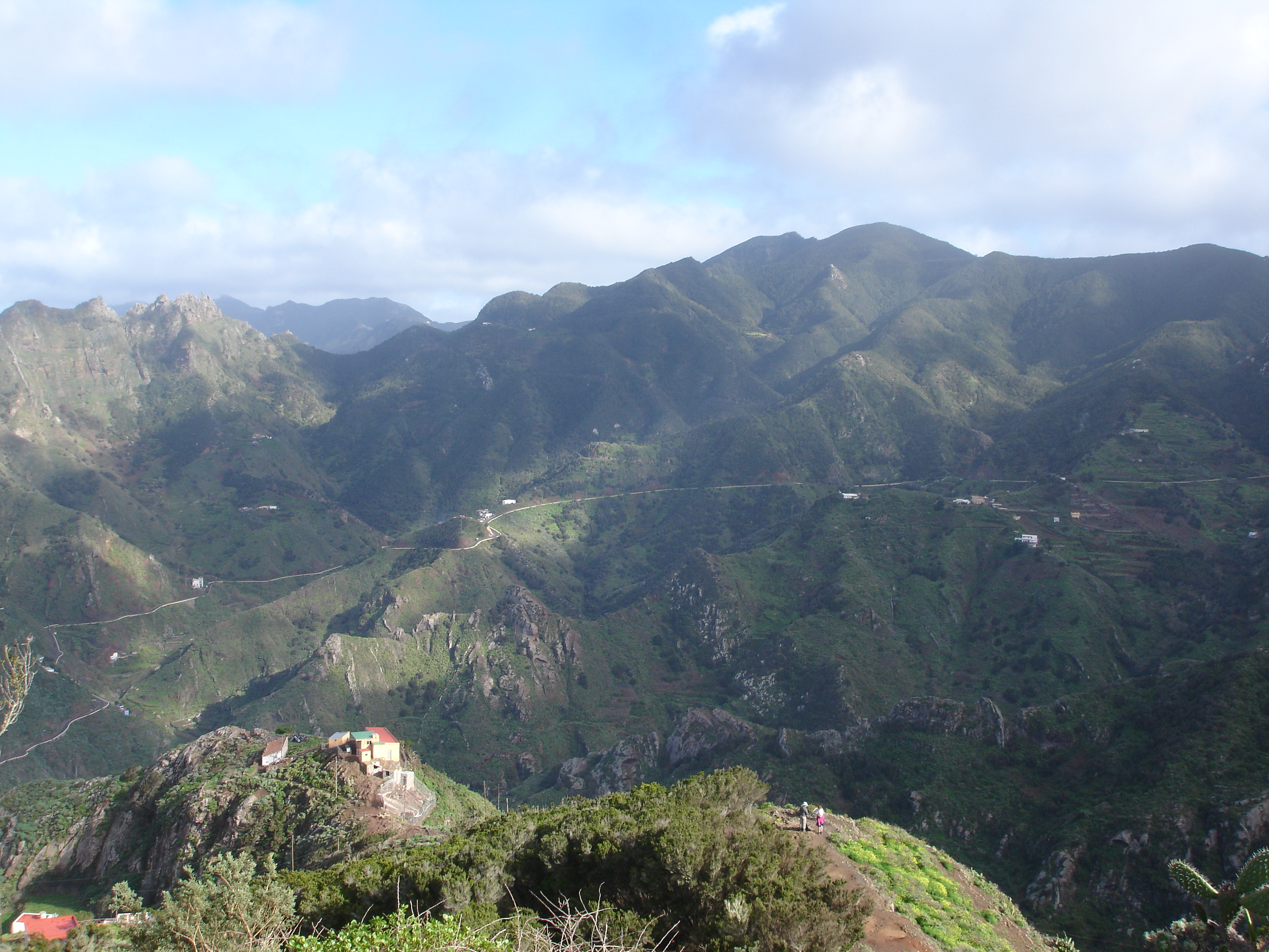
- The Anaga peninsula in the north-east bears the brunt of the prevailing winds, and so is often rainy or misty. The mountains are steep and dramatic and you can encounter lush vegetation, and forest paths through moss-covered trees. This promotional video gives you a good impression of the landscape. There are a number of well-signed straightforward walking routes from the Centro de Visitantes at Cruz del Carmen.
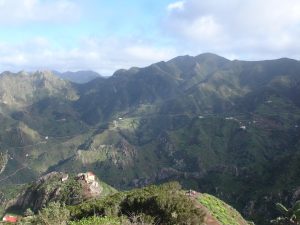
Anaga Peninsula, near Taborno
- The south in contrast is almost always dry and sunny, and very pleasant for walking during the winter months. The ground is dry, and the predominant vegetation is scrub rather than grass, and there are also pleasant walks along stretches of the rocky coastline.
- The crater of Teide in the centre of Tenerife covers a circular area of around 10 miles diameter. Here you’re walking on volcanic rock or ash, with amazing rock formations and dramatic colours, and you can be walking in brilliant sunshine above the cloud layer covering other parts of the island. To protect this area you must walk on designated routes only – to see a map of these download the Park Brochure from this page. Encircling the crater rim for a distance of around 5 miles all round is a massive area of pine forest known as the Corona Forestal, drier and sparser towards the south-west, denser and moister towards the north-east. Many lovely forest walks are available, but with sometimes only intermittent views.
- The north and north-west of the island are more temperate – not as dry as the south nor as wet as Anaga – but also more populous, until you reach the Teno area in the north-west. The Orotava valley is popular for walking, although clouds can build up to cover the whole area during the course of the day. The Teno Parque Rural includes the famous Masca Gorge, and you can get a good idea of the landscape from this promotional video.
Walking Sites for Tenerife
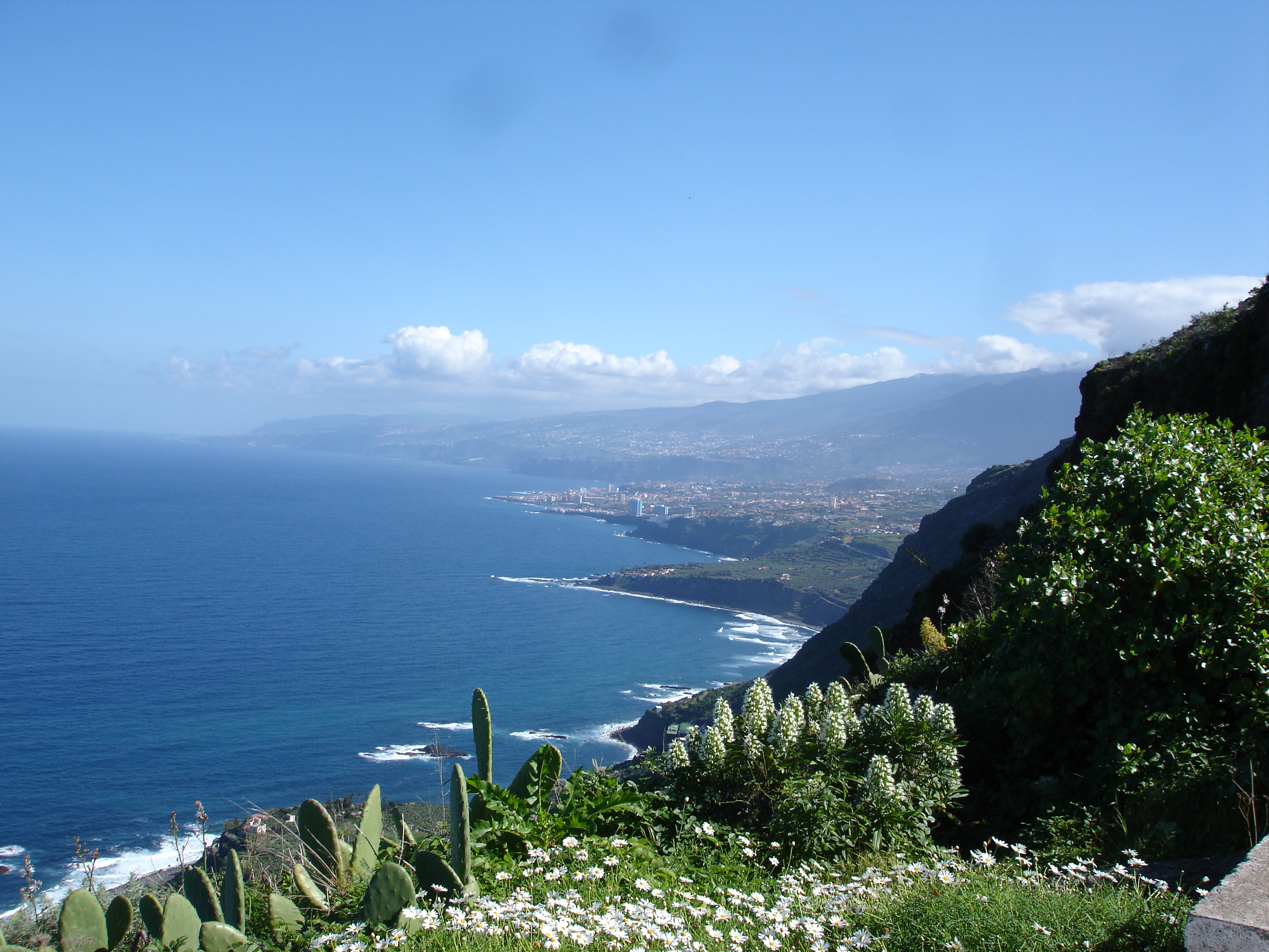
North Coast near San Juan de la Rambla
Here are some good walking sites for Tenerife – some of them also give you good opportunities to practise your Spanish!
- Tenerife Nature Walks
- Francisco Fariño
- Tenerife Senderos
- Senderos de mi Tierra
- Todo Tenerife
- PapaPateo
The major long distance route in Tenerife is the GR131, which goes from La Esperanza (situated towards the NE of the island), south-west for 86 kilometers to Arona (situated towards the SW). It’s split into 5 stages, with stage 3 skirting the crater to the SE of Teide. Information about this route and PR routes on the island can be found on Red de Senderos de Tenerife.
Some of the local municipios produce brochures of local walks (senderos locales, marked with green and white markers). These brochures will be in Spanish and of varying quality. They may have a map with contours, but obviously not GPS coordinates. However, you can generally find a trail on wikiloc where someone has done that route, and download the GPS coordinates from there. For example:
Maps and Publications
The best walking map we’ve found that covers the whole island is the 1:50000 Tenerife Map produced by freytag & berndt. There are both Sunflower Books (2 books, one covering the north of the island, and one covering the south and the island of La Gomera) and Rother Walking Guides to Tenerife. Check out Traildino for suggestions of other maps and guide books for this area.