
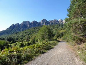
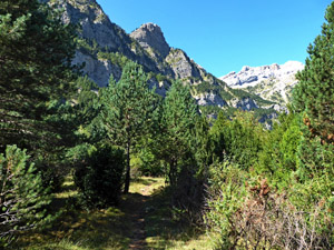
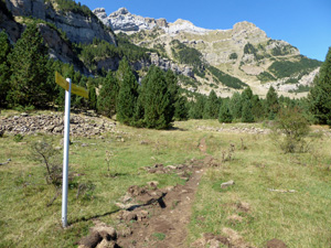
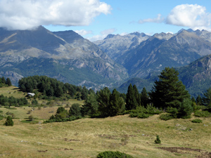
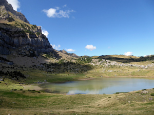
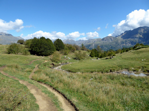
Ibon Piedrafita Circuit from Faunistico Car Park
A circular walk on well marked paths passing woodland and Alpine meadows with stunning views of soaring cliffs and panoramas of the “Val de Tena”
Spanish maps included within these descriptions are provided courtesy of the Spanish IGN and remain © Instituto Geográfico Nacional.
OSM (OpenStreetMap) and OCM (OpenCycleMap) maps are © OpenStreetMap Contributors. The OSM project welcomes contributions from all to enrich the map data, which is made freely available. Land (Thunderforest Landscape) maps are © Thunderforest based on data © OpenStreetMap contributors.
The grade of this walk is M/B, which means
M – Moderate: up to 12km in length, less than 400 metres ascent and less than 50% rough going.
B – Less than half the route on rough ground
| Nearest town | Piedrafita de Jaca |
| Directions to start | |
| Start point (Lat/Long) | 42.697130, -0.333280 Click here to view in Google Maps (in a new browser tab) |
| Length (km) | 10.30 |
| Ascent (metres) | 390 |
| Walking time (hours) | 3.5 |
| Total time (hours) | 4.25 |
| Recommendations or Restrictions | From A136 10km north of Biescas, (km 8.75) turn West onto asphalted narrow road to Piedrafita de Jaca. Pass through village and turn very sharply left to continue climbing to the car park opposite the entrance to the wildlife park “Parque Faunistico Launiacha” |
Download walk descriptionDownload GPS file
Comments
Ibon Piedrafita Circuit from Faunistico Car Park — No Comments
HTML tags allowed in your comment: <a href="" title=""> <abbr title=""> <acronym title=""> <b> <blockquote cite=""> <cite> <code> <del datetime=""> <em> <i> <q cite=""> <s> <strike> <strong>