
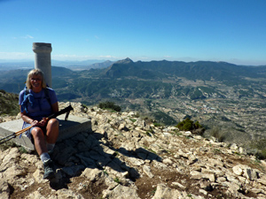
Mijhorn summit
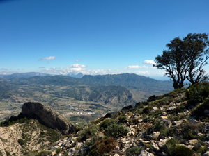
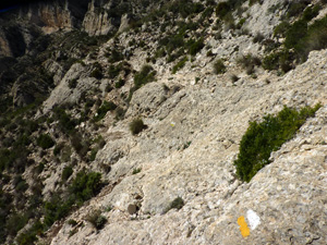
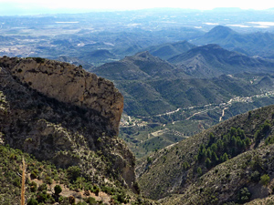
A circular route to the summit of Mijhorn (1226m) and the cliffs of the Collado de Clot on well defined and marked paths (PR CV-212) Some scrambling and exposure near the summit.
Spanish maps included within these descriptions are provided courtesy of the Spanish IGN and remain © Instituto Geográfico Nacional.
OSM (OpenStreetMap) and OCM (OpenCycleMap) maps are © OpenStreetMap Contributors. The OSM project welcomes contributions from all to enrich the map data, which is made freely available. Land (Thunderforest Landscape) maps are © Thunderforest based on data © OpenStreetMap contributors.
The grade of this walk is S/B/Scr, which means
S – Strenuous: More than 600 metres ascent and/or more than 15km in length with steep, loose or heavily vegetated sections.
B – Less than half the route on rough ground.
Scr – Scrambling: This implies the need for handholds to ascend steep rock pitches with a sense of exposure to vertigo and where a slip could lead to a serious accident.
| Nearest town | Xixona |
| Directions to start |
From Xixona (Jijona) take CV 810 towards Tibi. At edge of town pass roundabout with access to castle to your left. Turn right at junction with a yellow vent pipe after 500m ignoring “No entry” signs. |
| Start point (Lat/Long) | 38.546400, -0.522440 Click here to view in Google Maps (in a new browser tab) |
| Length (km) | 7.60 |
| Ascent (metres) | 650 |
| Walking time (hours) | 2.66 |
| Total time (hours) | 3.5 |
| Recommendations or Restrictions | Do not do this walk in very windy conditions as approach to the summit is exposed and difficult. |
Download walk descriptionDownload GPS file


Comments
Mijhorn summit — No Comments
HTML tags allowed in your comment: <a href="" title=""> <abbr title=""> <acronym title=""> <b> <blockquote cite=""> <cite> <code> <del datetime=""> <em> <i> <q cite=""> <s> <strike> <strong>