
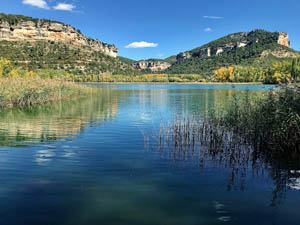
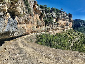
Cliff Top Circuit (Via del Escaleron & la Raya)
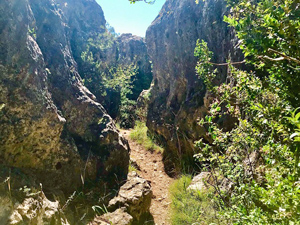
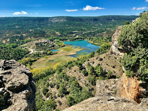
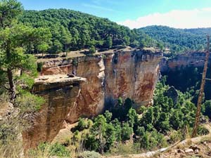
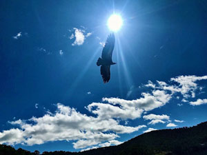
This superb route follows the Y/W marked PR – CU37 throughout. Weaving up via El Escaleron to reach and follow the cliff top (the home of many Vultures). To circle around the valley which surrounds the attractive lagoon, via numerous miradors, before descending via La Raya, through impressive cliff scenery. Mostly good paths and tracks. Some steep ground both up and down the cliffs. The traverse across the cliffs of La Raya is a little exposed, though the ledge is quite wide and level. A very photogenic route.
Spanish maps included within these descriptions are provided courtesy of the Spanish IGN and remain © Instituto Geográfico Nacional.
OSM (OpenStreetMap) and OCM (OpenCycleMap) maps are © OpenStreetMap Contributors. The OSM project welcomes contributions from all to enrich the map data, which is made freely available. Land (Thunderforest Landscape) maps are © Thunderforest based on data © OpenStreetMap contributors.
The grade of this walk is MS/B, which means
MS – Moderately Strenuous: Up to 600 metres ascent and/or no more than 15 km in length with some rough going taken at a reasonable pace.
B – Less than half the route on rough ground
| Nearest town | Una |
| Directions to start |
From Cuenca follow the CM 2105 to Una. Park at the edge of the town beside walk information boards, opposite a bar and Hostel, at the junction with C’ de los Martires de Africa. |
| Start point (Lat/Long) | 40.223470, -1.979100 Click here to view in Google Maps (in a new browser tab) |
| Length (km) | 10.40 |
| Ascent (metres) | 460 |
| Walking time (hours) | 2.5 |
| Total time (hours) | 4.5 |
| Recommendations or Restrictions | None |
Download walk descriptionDownload GPS file
Very amazing tour, highly recommended