
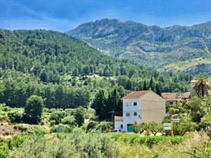
Circuit around the flanks of Benicadell
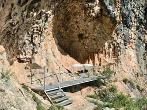
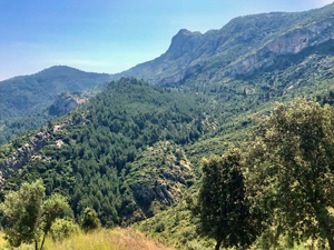
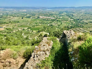
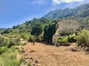
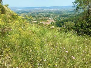
A circuit across the lower slopes of the magnificent peak of Benicadell. Visiting caves with paintings (note; gates were locked at the time of writing) and a ruined castell. Mainly good easy paths though some are steep both up and down. Fine views over the countryside.
Spanish maps included within these descriptions are provided courtesy of the Spanish IGN and remain © Instituto Geográfico Nacional.
OSM (OpenStreetMap) and OCM (OpenCycleMap) maps are © OpenStreetMap Contributors. The OSM project welcomes contributions from all to enrich the map data, which is made freely available. Land (Thunderforest Landscape) maps are © Thunderforest based on data © OpenStreetMap contributors.
The grade of this walk is MS/B, which means
MS – Moderately Strenuous: Up to 600 metres ascent and/or no more than 15 km in length with some rough going taken at a reasonable pace.
B – Less than half the route on rough ground
| Nearest town | Beniatjar |
| Directions to start |
From CV-60 take CV-622. At roundabout at edge of Beniatjar. Turn 1st R into C’ Cementerio and park at side of road. |
| Start point (Lat/Long) | 38.849740, -0.416930 Click here to view in Google Maps (in a new browser tab) |
| Length (km) | 9.00 |
| Ascent (metres) | 498 |
| Walking time (hours) | 2.5 |
| Total time (hours) | 4.5 |
| Recommendations or Restrictions | None |
Download walk descriptionDownload GPS file
Comments
Circuit around the flanks of Benicadell — No Comments
HTML tags allowed in your comment: <a href="" title=""> <abbr title=""> <acronym title=""> <b> <blockquote cite=""> <cite> <code> <del datetime=""> <em> <i> <q cite=""> <s> <strike> <strong>