
Bodoix Via Castell D’Ambra
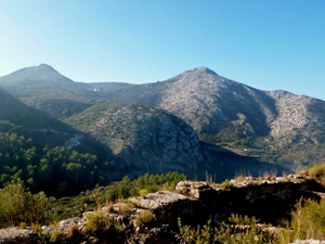
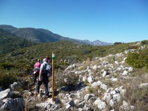
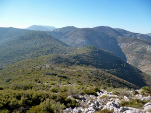
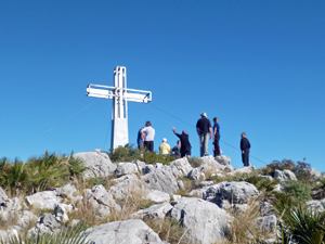
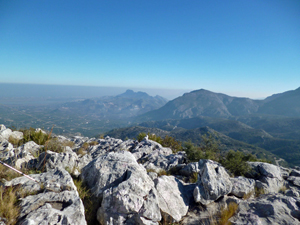
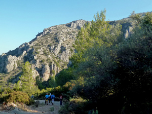
Small amount on roads but mainly on marked tracks and paths albeit a short stretch of path is a little rocky under foot. Lovely view particularly from the castle.
Spanish maps included within these descriptions are provided courtesy of the Spanish IGN and remain © Instituto Geográfico Nacional.
OSM (OpenStreetMap) and OCM (OpenCycleMap) maps are © OpenStreetMap Contributors. The OSM project welcomes contributions from all to enrich the map data, which is made freely available. Land (Thunderforest Landscape) maps are © Thunderforest based on data © OpenStreetMap contributors.
The grade of this walk is MS/B, which means
MS – Moderately Strenuous: Up to 600 metres ascent and/or no more than 15 km in length with some rough going taken at a reasonable pace.
B – Less than half the route on rough ground
| Nearest town | Pego |
| Directions to start |
Pla del Metge Almela. Approaching Pego from:–Orba on CV715 turn L after PEGO town sign (large steel pylon on corner) into wide road. Continue to Stop sign and you’re there. -El Vergel/N332 on CV700 turn R at 2nd island signed Adsubia. Straight on over two islands, L at ‘T’ junction, pass Mercadona on LHS, straight on at next island, straight on at Stop sign, R immediately after college and you’re there. |
| Start point (Lat/Long) | 38.838364, -0.121418 Click here to view in Google Maps (in a new browser tab) |
| Length (km) | 11.00 |
| Ascent (metres) | 500 |
| Walking time (hours) | 3.25 |
| Total time (hours) | 4.50 |
| Recommendations or Restrictions | None |
Download walk descriptionDownload GPS file
Comments
Bodoix Via Castell D’Ambra — No Comments
HTML tags allowed in your comment: <a href="" title=""> <abbr title=""> <acronym title=""> <b> <blockquote cite=""> <cite> <code> <del datetime=""> <em> <i> <q cite=""> <s> <strike> <strong>