
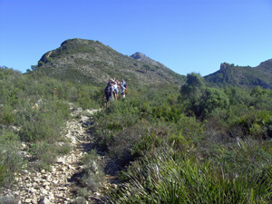
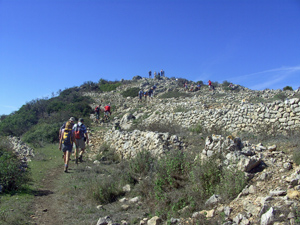
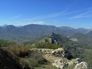
Castell d’Aixa circuit from Llosa de Comacho
Walk from Llosa climb to Castell d’Aixa, along ridge, then through Barranc del Migjorn. Then past the Castell del Ocaive and back to Llosa.
Spanish maps included within these descriptions are provided courtesy of the Spanish IGN and remain © Instituto Geográfico Nacional.
OSM (OpenStreetMap) and OCM (OpenCycleMap) maps are © OpenStreetMap Contributors. The OSM project welcomes contributions from all to enrich the map data, which is made freely available. Land (Thunderforest Landscape) maps are © Thunderforest based on data © OpenStreetMap contributors.
The grade of this walk is S/B, which means
S – Strenuous: More than 600 metres ascent and/or more than 15km in length with steep, loose or heavily vegetated sections.
B – Less than half the route on rough ground.
| Nearest town | Llosa de Comacho |
| Directions to start |
Follow the CV720 from Pedreguer to Llosa de Comacho. At the far end of the village turn R into a small road signposted to a Farmacia. At the end of this road, turn R and park on the LHS. |
| Start point (Lat/Long) | 38.771283, -0.009141 Click here to view in Google Maps (in a new browser tab) |
| Length (km) | 14.50 |
| Ascent (metres) | 640 |
| Walking time (hours) | 4.25 |
| Total time (hours) | 6.00 |
| Recommendations or Restrictions |
Download walk descriptionDownload GPS file

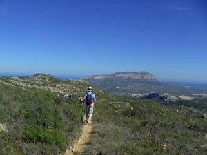
Did this walk starting in Pedregeur, well signposted for most of the route. Very enjoyable with lovely views of the coast and surrounding mountains.
We did the walk as described. Lovely and beautiful, but the path as described from km 11,6 we experienced totally different and we think this is because the route has not been updated for quite a while. The path is NOT well trodden but with a lot a green bush and difficult to find. At the top we could not find the terras despite Garmin. It was not an easy path at all. So either the description is wrong or the Garmin track is different. We went back to the 11.6 point and followed the yellow white marks. Far better.