
Teide from Sea to Summit – Montana Blanca to Refugio Alta Vista
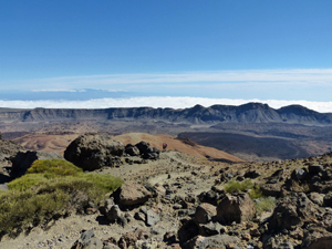
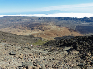
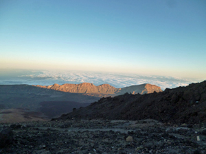
A demanding mountain excursion with views back across Montana Blanca and the “outer” rim of this volcanic plateau.
Spanish maps included within these descriptions are provided courtesy of the Spanish IGN and remain © Instituto Geográfico Nacional.
OSM (OpenStreetMap) and OCM (OpenCycleMap) maps are © OpenStreetMap Contributors. The OSM project welcomes contributions from all to enrich the map data, which is made freely available. Land (Thunderforest Landscape) maps are © Thunderforest based on data © OpenStreetMap contributors.
The grade of this walk is VS/B, which means
VS – Very Strenuous: More than 800 metres ascent and/or more than 20km in length with steep, loose or heavily vegetated sections.
B – Less than half the route on rough ground.
| Nearest town | Teide from Sea to Summit |
| Directions to start |
From the coastal resorts to the south follow the TF51 road. Pass the Parador and the Teleferico and a few kilometres after this you reach the Montan Blanca car park on the LHS. Spaces are limited so be prepared to retrace your steps to park either at an intermediate point or at the Teleferico some 2.5km away. |
| Start point (Lat/Long) | 28.259375, -16.603611 Click here to view in Google Maps (in a new browser tab) |
| Length (km) | 7.00 |
| Ascent (metres) | 970 |
| Walking time (hours) | 2.50 |
| Total time (hours) | 4.50 |
| Recommendations or Restrictions | Altitude and your ability to cope with thin air will set your pace on this walk. If you experience nausea or sever headache it will be best to go down.
The second half of the ascent is on rough footpath where descent is tricky. |
Download walk descriptionDownload GPS file
Comments
Teide from Sea to Summit – Montana Blanca to Refugio Alta Vista — No Comments
HTML tags allowed in your comment: <a href="" title=""> <abbr title=""> <acronym title=""> <b> <blockquote cite=""> <cite> <code> <del datetime=""> <em> <i> <q cite=""> <s> <strike> <strong>