
Teide from Sea to Summit – Refugio Alta Vista to summit and Teleferico
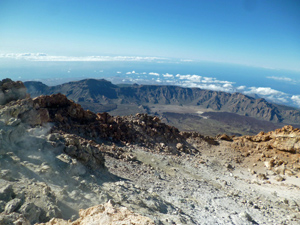
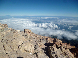
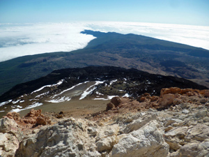
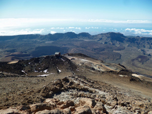
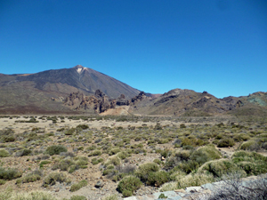
A magnificent outing with stupendous views across the old caldera plateau and the ranges all around. On a clear day you will be able to see many of the other nearby islands!
Spanish maps included within these descriptions are provided courtesy of the Spanish IGN and remain © Instituto Geográfico Nacional.
OSM (OpenStreetMap) and OCM (OpenCycleMap) maps are © OpenStreetMap Contributors. The OSM project welcomes contributions from all to enrich the map data, which is made freely available. Land (Thunderforest Landscape) maps are © Thunderforest based on data © OpenStreetMap contributors.
The grade of this walk is MS/B/X, which means
MS – Moderately Strenuous: Up to 600 metres ascent and/or no more than 15 km in length with some rough going taken at a reasonable pace.
B – Less than half the route on rough ground
X – Experienced walkers route: the route requires considerable stamina and/or significant scrambling skills on rough, steep or exposed sections.
| Nearest town | Teide from Sea to Summit |
| Directions to start |
You can only achieve this by staying at the Refugio (The alternative is to take a very long and demanding walk up from Montana Blanca) |
| Start point (Lat/Long) | 28.274019, -16.629413 Click here to view in Google Maps (in a new browser tab) |
| Length (km) | 3.10 |
| Ascent (metres) | 480 |
| Walking time (hours) | 2.50 |
| Total time (hours) | 0.00 |
| Recommendations or Restrictions | Altitude effects and the possibility of real altitude sickness should be watched with rigour! |
Download walk descriptionDownload GPS file

Comments
Teide from Sea to Summit – Refugio Alta Vista to summit and Teleferico — No Comments
HTML tags allowed in your comment: <a href="" title=""> <abbr title=""> <acronym title=""> <b> <blockquote cite=""> <cite> <code> <del datetime=""> <em> <i> <q cite=""> <s> <strike> <strong>