
GR11 – Day 17. Banos de Panticosa to Refugio Bujaruelo
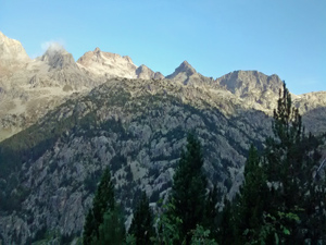
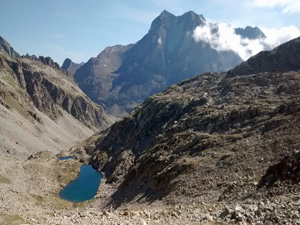
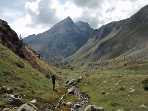
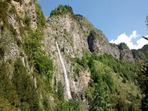
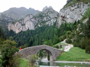
A walk across high ridges of the Pyrenees before a long descent down a beautiful valley followed by arrival at a mediaeval bridge!
Spanish maps included within these descriptions are provided courtesy of the Spanish IGN and remain © Instituto Geográfico Nacional.
OSM (OpenStreetMap) and OCM (OpenCycleMap) maps are © OpenStreetMap Contributors. The OSM project welcomes contributions from all to enrich the map data, which is made freely available. Land (Thunderforest Landscape) maps are © Thunderforest based on data © OpenStreetMap contributors.
The grade of this walk is VS/C, which means
VS – Very Strenuous: More than 800 metres ascent and/or more than 20km in length with steep, loose or heavily vegetated sections.
C – More than half the route on rough ground.
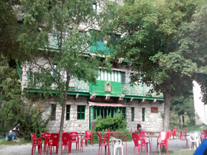
| Nearest town | Banos de Panticosa |
| Directions to start |
Starting from Jaca in northern Spain, travel E towards Sabinanigo and then N on the N260 and the A136 to turn R onto the A2606 initially to Panticosa and then onwards to Banos de Panticosa. The car park is reached by turning L just after the reservoir end and then R at the far side. |
| Start point (Lat/Long) | 42.762327, -0.233938 Click here to view in Google Maps (in a new browser tab) |
| Length (km) | 22.00 |
| Ascent (metres) | 1150 |
| Walking time (hours) | 6.00 |
| Total time (hours) | 8.00 |
| Recommendations or Restrictions | Linear walk, but road heads at both ends. Strenuous and demanding day out! Fantastic scenery. |
Download walk descriptionDownload GPS file
Comments
GR11 – Day 17. Banos de Panticosa to Refugio Bujaruelo — No Comments
HTML tags allowed in your comment: <a href="" title=""> <abbr title=""> <acronym title=""> <b> <blockquote cite=""> <cite> <code> <del datetime=""> <em> <i> <q cite=""> <s> <strike> <strong>