
Circuit of Barranc del Cau and Alt del Ample from Jalon
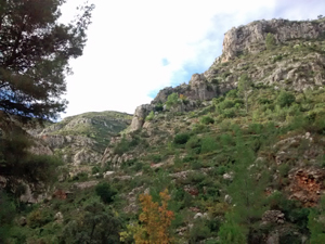
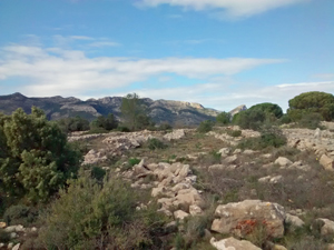
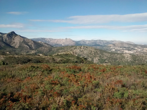
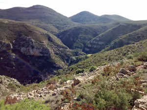
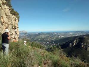
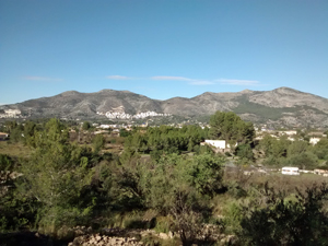
The walk will take you up the path to the east of Barranc del Cau following the water pipe, circling around Les Planisses and returning via Alt de Ample. Generally the paths and tracks are good but there will be a short stretch over rough ground; the views are worth the effort!
Spanish maps included within these descriptions are provided courtesy of the Spanish IGN and remain © Instituto Geográfico Nacional.
OSM (OpenStreetMap) and OCM (OpenCycleMap) maps are © OpenStreetMap Contributors. The OSM project welcomes contributions from all to enrich the map data, which is made freely available. Land (Thunderforest Landscape) maps are © Thunderforest based on data © OpenStreetMap contributors.
The grade of this walk is MS/B, which means
MS – Moderately Strenuous: Up to 600 metres ascent and/or no more than 15 km in length with some rough going taken at a reasonable pace.
B – Less than half the route on rough ground
| Nearest town | Jalon |
| Directions to start |
From the petrol station in Jalon, take the minor road to the left of the petrol station. Shortly after this road turns sharp right, park on the grass just before the Jalon – Bernia road |
| Start point (Lat/Long) | 38.731992, -0.011673 Click here to view in Google Maps (in a new browser tab) |
| Length (km) | 12.00 |
| Ascent (metres) | 470 |
| Walking time (hours) | 3.33 |
| Total time (hours) | 4.66 |
| Recommendations or Restrictions | None. Note there are several similar walks available on Walks in Spain. Check for details. |
Download walk descriptionDownload GPS file
Meant to vote 5 star but I must have sent it by mistake. Super walk and trip up to Alt de Ample brilliant. Thank you CBMW
Really good walk – quite tough in places going up the Barranco but a very clear path & great views the whole way.
Done in late June 2022 so hot by the end – I’d suggest starting around 7am to beat the heat on the very open 2nd half.