
Cerro Pena Del Aguila
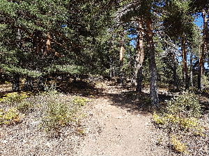
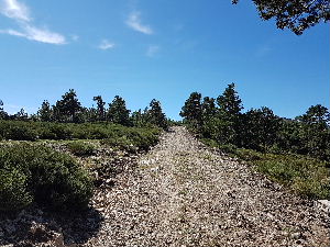
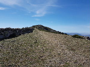
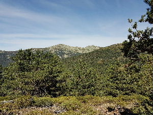
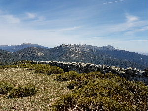
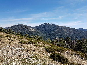
The start and the finish of the walk are in the forested area of the National Park. The views on breaking out from the forested area afford you views around the whole of the Guadarrama area. A steep climb on a short route but worth the effort for all the views.
Spanish maps included within these descriptions are provided courtesy of the Spanish IGN and remain © Instituto Geográfico Nacional.
OSM (OpenStreetMap) and OCM (OpenCycleMap) maps are © OpenStreetMap Contributors. The OSM project welcomes contributions from all to enrich the map data, which is made freely available. Land (Thunderforest Landscape) maps are © Thunderforest based on data © OpenStreetMap contributors.
The grade of this walk is S/B, which means
S – Strenuous: More than 600 metres ascent and/or more than 15km in length with steep, loose or heavily vegetated sections.
B – Less than half the route on rough ground.
| Nearest town | Cercedilla |
| Directions to start |
From Cercedilla train station go up the hill. The main road goes right but there is a road, Carretera De las Dehesas which goes straight ahead. It is signed M966 Las Dehesas. Continue up this road for 2km to the information office on right hand side. Continue up the road bearing right on a one way road. Continue up the road past a couple of parking areas. The road then turns left uphill before turning left again and going downhill. Park on the left hand side as soon as possible. |
| Start point (Lat/Long) | 40.770490, -4.069680 Click here to view in Google Maps (in a new browser tab) |
| Length (km) | 9.00 |
| Ascent (metres) | 640 |
| Walking time (hours) | 3.25 |
| Total time (hours) | 4 |
| Recommendations or Restrictions | Note that parking can be difficult at week-ends and holidays. |
Download walk descriptionDownload GPS file
Comments
Cerro Pena Del Aguila — No Comments
HTML tags allowed in your comment: <a href="" title=""> <abbr title=""> <acronym title=""> <b> <blockquote cite=""> <cite> <code> <del datetime=""> <em> <i> <q cite=""> <s> <strike> <strong>