
Circuit to the Ermita de Nuestra Senora de la Luz from Somaniezo
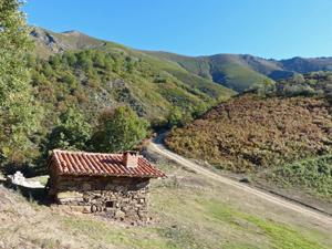
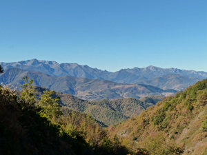
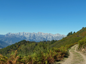
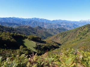
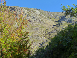
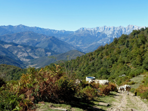
A steep climb up to the Ermita de Nuestra Senora de la Luz in open country on the flanks of Pena Sagra followed by a traverse across the Pena to descend via Luriezo to our start point. Fantastic views back to the Cordillera and Picos. Deciduous trees.
Spanish maps included within these descriptions are provided courtesy of the Spanish IGN and remain © Instituto Geográfico Nacional.
OSM (OpenStreetMap) and OCM (OpenCycleMap) maps are © OpenStreetMap Contributors. The OSM project welcomes contributions from all to enrich the map data, which is made freely available. Land (Thunderforest Landscape) maps are © Thunderforest based on data © OpenStreetMap contributors.
The grade of this walk is S/A, which means
S – Strenuous: More than 600 metres ascent and/or more than 15km in length with steep, loose or heavily vegetated sections.
A – All good tracks.
| Nearest town | Somaniezo |
| Directions to start |
Just to the NE of Potes there is a roundabout on the outskirts of Ojedo where we turn S on the CA184. Follow this road through several villages for nearly 3km to find the CA870 signed to the L. Take this road ignoring turnings off and follow it to the end and the parking just outside Somaniezo. |
| Start point (Lat/Long) | 43.144782, -4.526734 Click here to view in Google Maps (in a new browser tab) |
| Length (km) | 13.50 |
| Ascent (metres) | 750 |
| Walking time (hours) | 3.75 |
| Total time (hours) | 5 |
| Recommendations or Restrictions | Best done Spring or Autumn with an early start to give shade for the ascent. |
Download walk descriptionDownload GPS file
Comments
Circuit to the Ermita de Nuestra Senora de la Luz from Somaniezo — No Comments
HTML tags allowed in your comment: <a href="" title=""> <abbr title=""> <acronym title=""> <b> <blockquote cite=""> <cite> <code> <del datetime=""> <em> <i> <q cite=""> <s> <strike> <strong>