
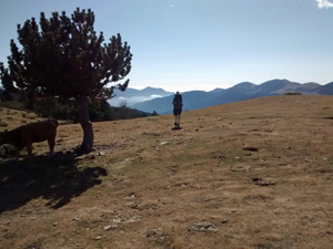
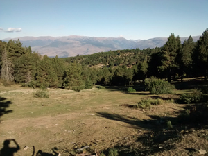
GR11 – Day 38. Vilallobent to Planoles
A high level traverse on the GR11. Difficult to accomplish as a day walk without adequate transport arrangements.
Spanish maps included within these descriptions are provided courtesy of the Spanish IGN and remain © Instituto Geográfico Nacional.
OSM (OpenStreetMap) and OCM (OpenCycleMap) maps are © OpenStreetMap Contributors. The OSM project welcomes contributions from all to enrich the map data, which is made freely available. Land (Thunderforest Landscape) maps are © Thunderforest based on data © OpenStreetMap contributors.
The grade of this walk is VS/B, which means
VS – Very Strenuous: More than 800 metres ascent and/or more than 20km in length with steep, loose or heavily vegetated sections.
B – Less than half the route on rough ground.
| Nearest town | Puigcerda |
| Directions to start |
The C16 road leads almost from Barcelona N towards the French border. Once through the Cadi tunnel follow signs towards Puigcerda and then minor roads towards Vilallobent. |
| Start point (Lat/Long) | 42.406333, 1.950860 Click here to view in Google Maps (in a new browser tab) |
| Length (km) | 23.00 |
| Ascent (metres) | 1180 |
| Walking time (hours) | 4.33 |
| Total time (hours) | 6.5 |
| Recommendations or Restrictions | Long and demanding day. Author used taxi to Vilallobent to shorten the day by some 4km! (Otherwise 27km) |
Download walk descriptionDownload GPS file
Comments
GR11 – Day 38. Vilallobent to Planoles — No Comments
HTML tags allowed in your comment: <a href="" title=""> <abbr title=""> <acronym title=""> <b> <blockquote cite=""> <cite> <code> <del datetime=""> <em> <i> <q cite=""> <s> <strike> <strong>