
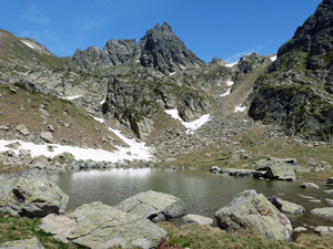
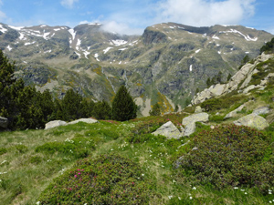
Refugi de Juclar circuit from Vall d’Incles
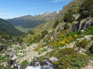
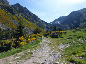
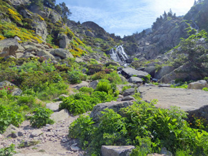
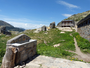
A circuit up a beautiful valley leading to a refuge and then a high level traverse past small lakes and extensive views before dropping down into the Riu del Manegor and back to the bus stop.
Spanish maps included within these descriptions are provided courtesy of the Spanish IGN and remain © Instituto Geográfico Nacional.
OSM (OpenStreetMap) and OCM (OpenCycleMap) maps are © OpenStreetMap Contributors. The OSM project welcomes contributions from all to enrich the map data, which is made freely available. Land (Thunderforest Landscape) maps are © Thunderforest based on data © OpenStreetMap contributors.
The grade of this walk is S/C, which means
S – Strenuous: More than 600 metres ascent and/or more than 15km in length with steep, loose or heavily vegetated sections.
C – More than half the route on rough ground.
| Nearest town | Soldeu |
| Directions to start |
Entering Andorra from the S (in Spain) proceed up along the CG1 to Andorra la Vella and then the CG2 signed towards France. Continue through Encamp and then find a turn on the LHS at the head of a sweeping road bend beyond El Tarter. If arriving before 9am you may be able to drive to the road head, otherwise you must park here and take a small transfer bus up to the head of the valley (€3 rtn in 2018) |
| Start point (Lat/Long) | 42.602210, 1.686357 Click here to view in Google Maps (in a new browser tab) |
| Length (km) | 8.00 |
| Ascent (metres) | 650 |
| Walking time (hours) | 3.25 |
| Total time (hours) | 5 |
| Recommendations or Restrictions | None |
Download walk descriptionDownload GPS file
Comments
Refugi de Juclar circuit from Vall d’Incles — No Comments
HTML tags allowed in your comment: <a href="" title=""> <abbr title=""> <acronym title=""> <b> <blockquote cite=""> <cite> <code> <del datetime=""> <em> <i> <q cite=""> <s> <strike> <strong>