
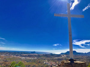
Senija to Penyes Blanques
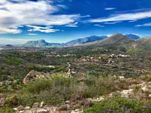
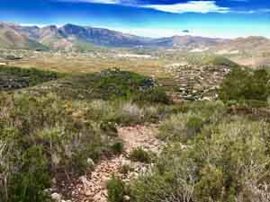
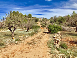
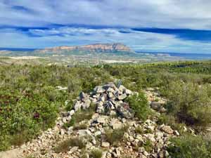
From Senija over the rolling hills to the north and on to the summit of Penyes Blanques. Returning back along the undulating ridge to reach the cross of Senija and the descent to the village. The route is a mini rollercoaster as it crosses five tops. Paths and tracks, mainly good but with some rugged sections. The route passes through lovely countryside and there are fine and varied views.
Spanish maps included within these descriptions are provided courtesy of the Spanish IGN and remain © Instituto Geográfico Nacional.
OSM (OpenStreetMap) and OCM (OpenCycleMap) maps are © OpenStreetMap Contributors. The OSM project welcomes contributions from all to enrich the map data, which is made freely available. Land (Thunderforest Landscape) maps are © Thunderforest based on data © OpenStreetMap contributors.
The grade of this walk is M/B, which means
M – Moderate: up to 12km in length, less than 400 metres ascent and less than 50% rough going.
B – Less than half the route on rough ground
| Nearest town | Senija |
| Directions to start |
From CV-745 enter Senija at the eastern end along Avinguda de les Corts Valenciana which bypasses the village centre. Park on the side of the road near a play area for small children, which has an electric sub station next to it and a road crossing opposite (There is another large play area further up the road). |
| Start point (Lat/Long) | 38.729200, 0.042200 Click here to view in Google Maps (in a new browser tab) |
| Length (km) | 8.00 |
| Ascent (metres) | 390 |
| Walking time (hours) | 2.25 |
| Total time (hours) | 4 |
| Recommendations or Restrictions | None |
Download walk descriptionDownload GPS file

Comments
Senija to Penyes Blanques — No Comments
HTML tags allowed in your comment: <a href="" title=""> <abbr title=""> <acronym title=""> <b> <blockquote cite=""> <cite> <code> <del datetime=""> <em> <i> <q cite=""> <s> <strike> <strong>