
Arroyo Frio and Rio Guadalquivir
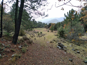
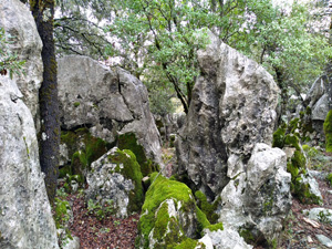
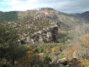
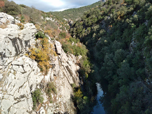
>A woodland walk initially with improving scenery as the day goes on. The highlight is the walk around the craggy buttresses of El Lanchon and the finish along the banks of the Guadalquivir is delightful.
Spanish maps included within these descriptions are provided courtesy of the Spanish IGN and remain © Instituto Geográfico Nacional.
OSM (OpenStreetMap) and OCM (OpenCycleMap) maps are © OpenStreetMap Contributors. The OSM project welcomes contributions from all to enrich the map data, which is made freely available. Land (Thunderforest Landscape) maps are © Thunderforest based on data © OpenStreetMap contributors.
The grade of this walk is MS/A, which means
MS – Moderately Strenuous: Up to 600 metres ascent and/or no more than 15 km in length with some rough going taken at a reasonable pace.
A – All on good tracks
| Nearest town | Arroyo Frio |
| Directions to start |
From the A92N motorway which runs between Puerto Lumbreras and Granada take the A315 going N and then the A319 to arrive at Cazorla. Continue on this road through the village and on past Burunchel and further on to the village of Arroyo Frio. Park on the RHS in a car park just after the village sign. |
| Start point (Lat/Long) | 37.944812, -2.920863 Click here to view in Google Maps (in a new browser tab) |
| Length (km) | 15.00 |
| Ascent (metres) | 560 |
| Walking time (hours) | 4.25 |
| Total time (hours) | 5.75 |
| Recommendations or Restrictions | None |
Download walk descriptionDownload GPS file
Comments
Arroyo Frio and Rio Guadalquivir — No Comments
HTML tags allowed in your comment: <a href="" title=""> <abbr title=""> <acronym title=""> <b> <blockquote cite=""> <cite> <code> <del datetime=""> <em> <i> <q cite=""> <s> <strike> <strong>