
Bola del Mundo and La Maliciosa
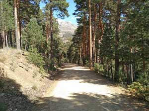
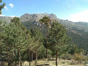
A walk over a summit clad with radio equipment followed by an easy ascent of a rocky top leading to a tough barranco descent and then easier and more enjoyable return routes through forest and across a ridge.
Spanish maps included within these descriptions are provided courtesy of the Spanish IGN and remain © Instituto Geográfico Nacional.
OSM (OpenStreetMap) and OCM (OpenCycleMap) maps are © OpenStreetMap Contributors. The OSM project welcomes contributions from all to enrich the map data, which is made freely available. Land (Thunderforest Landscape) maps are © Thunderforest based on data © OpenStreetMap contributors.
The grade of this walk is VS/B, which means
VS – Very Strenuous: More than 800 metres ascent and/or more than 20km in length with steep, loose or heavily vegetated sections.
B – Less than half the route on rough ground.
| Nearest town | Cercedilla |
| Directions to start |
Cercedilla is reached to the NW of Madrid from the AP6 motorway at junction 47. The M614 and M622 lead to the village with the railway station on the outskirts. Take the railway from here or drive up to Puerto de Navacerrada on the M622 and M601. |
| Start point (Lat/Long) | 40.789532, -4.001970 Click here to view in Google Maps (in a new browser tab) |
| Length (km) | 16.00 |
| Ascent (metres) | 900 |
| Walking time (hours) | 4.5 |
| Total time (hours) | 6 |
| Recommendations or Restrictions | The descent from the col between Bola del Mundo and Maliciosa is unpleasant. |
Download walk descriptionDownload GPS file
Comments
Bola del Mundo and La Maliciosa — No Comments
HTML tags allowed in your comment: <a href="" title=""> <abbr title=""> <acronym title=""> <b> <blockquote cite=""> <cite> <code> <del datetime=""> <em> <i> <q cite=""> <s> <strike> <strong>