
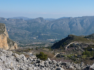
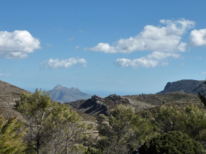
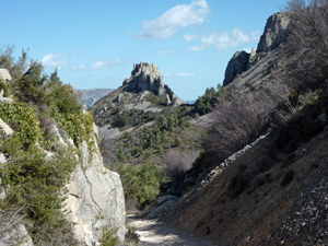
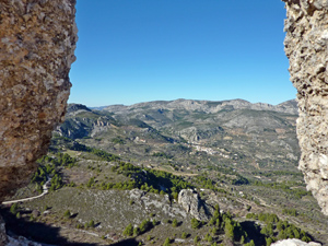
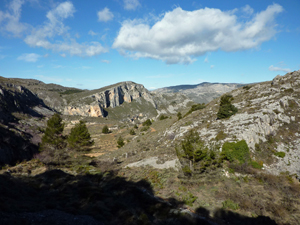
Confrides Castle Circuit from Partagas – longer
Mostly good paths. The semi-scramble to the castle is optional for those without a head for heights. There is a need to car share to avoid a long road walk at the end.
Spanish maps included within these descriptions are provided courtesy of the Spanish IGN and remain © Instituto Geográfico Nacional.
OSM (OpenStreetMap) and OCM (OpenCycleMap) maps are © OpenStreetMap Contributors. The OSM project welcomes contributions from all to enrich the map data, which is made freely available. Land (Thunderforest Landscape) maps are © Thunderforest based on data © OpenStreetMap contributors.
The grade of this walk is MS/B, which means
MS – Moderately Strenuous: Up to 600 metres ascent and/or no more than 15 km in length with some rough going taken at a reasonable pace.
B – Less than half the route on rough ground
| Nearest town | Benifato |
| Directions to start |
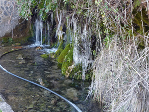
Follow the CV70 from Benidorm/Polop direction towards Guadalest/Alcoy. After Benimantell near to Km28 turn L (signed Benifato) soon after turn up 2nd RH street (sign for Fuente Partagat on wall ) continue up this steep minor road to come to the Partagas Fuente /Font. (Grid Ref: 38.657767,-0.241871, however you are advised not to use Sat Nav or Google Maps as it will take you round in circles) |
| Start point (Lat/Long) | 38.657767, -0.241871 Click here to view in Google Maps (in a new browser tab) |
| Length (km) | 11.20 |
| Ascent (metres) | 500 |
| Walking time (hours) | 3.33 |
| Total time (hours) | 5.25 |
| Recommendations or Restrictions |
Download walk descriptionDownload GPS file
Comments
Confrides Castle Circuit from Partagas – longer — No Comments
HTML tags allowed in your comment: <a href="" title=""> <abbr title=""> <acronym title=""> <b> <blockquote cite=""> <cite> <code> <del datetime=""> <em> <i> <q cite=""> <s> <strike> <strong>