
Barrancos Selinas and Selim
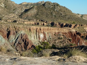
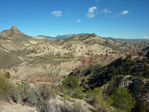
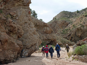
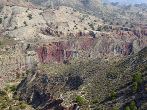
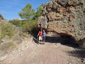
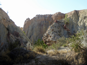
From the car park the walk follows faint paths along the top of a spectacular ridge before meeting a well defined and marked trail down into the barranco. The descent is steep and slippery in places. Once in the barranco we travel “downstream” through dramatic gorges to reach a dam. We then back-track up the barranco, passing our point of entry to reach another concrete dam which we cross the the aid of iron rungs and fixed chains. We continue up stream through more dramatic landscapes to a point where we can take a well defined (but rather worn) path back to the car park.
Spanish maps included within these descriptions are provided courtesy of the Spanish IGN and remain © Instituto Geográfico Nacional.
OSM (OpenStreetMap) and OCM (OpenCycleMap) maps are © OpenStreetMap Contributors. The OSM project welcomes contributions from all to enrich the map data, which is made freely available. Land (Thunderforest Landscape) maps are © Thunderforest based on data © OpenStreetMap contributors.
The grade of this walk is M/B/Scr, which means
M – Moderate: up to 12km in length, less than 400 metres ascent and less than 50% rough going.
B – Less than half the route on rough ground.
Scr – Scrambling: This implies the need for handholds to ascend steep rock pitches with a sense of exposure to vertigo and where a slip could lead to a serious accident.
| Nearest town | Jijona |
| Directions to start |
From CV800 just inland from Campello near km 3 (just North East of where CV800 passes under Autopista AP7) take roundabout exit to Mutxamel (norte). You will soon arrive at a roundabout with olive trees and sign “Mutxamel”. Go around this roundabout and go back the way you came! After about 50 m take the left-hand fork towards “aerodromo de Mutxamel” You will stay on this CV 819 to the start of the walk – but the drive is not straightforward. The road in parts is narrow and very winding. To start with you will pass through a modern urbanisation (where there is a bar/bodega “CJ5”) which is useful for refreshments after the walk (if it is open!). After the Urbanisations the road soon narrows and there is a global ban on overtaking and a 30km speed limit. Sign informs you that the road is narrow and in danger of sinking. Just before the village of Montnegre there is a T Junction where the road turns right (signposted Jijona) and a sign “Camino Muy Peligroso – PRECAUTION) Drive down the hill and cross the narrow bridge. The road turns sharply left and then continue to the village of Montnegre. As you pass the village name sign at the end of the village, take the right hand fork signposted to Jijona. Drive up the next hill around several bends and pass a large abandoned farmhouse on your left (3 floors high) Drive around the next bend right then one to the left and after a 100m or so you will reach a flat unpaved area to your right with a single mature pine tree – this is the car park. The drive from CV 800 will take you at least 35 minutes. (17 km) |
| Start point (Lat/Long) | 38.500500, -0.538700 Click here to view in Google Maps (in a new browser tab) |
| Length (km) | 7.30 |
| Ascent (metres) | 202 |
| Walking time (hours) | 4 |
| Total time (hours) | 4.5 |
| Recommendations or Restrictions | Do not attempt this walk if heavy storms are forecast.
Walking time for this trail is approximate as you will no doubt want to stop and admire the many geological features on display. You could march around much more quickly – but what would be the point? Gloves are useful for climbing over the dam. |
Download walk descriptionDownload GPS file
Comments
Barrancos Selinas and Selim — No Comments
HTML tags allowed in your comment: <a href="" title=""> <abbr title=""> <acronym title=""> <b> <blockquote cite=""> <cite> <code> <del datetime=""> <em> <i> <q cite=""> <s> <strike> <strong>