
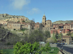
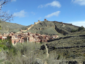
Albarracin – Rio Guadalaviar – Camino del Cid
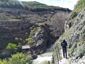
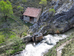
Very nice and varied walk in and around Albarracin. The first part consists of the local path along the river, the Paseo Fluvial del Guadalaviar SL-TE 48. We also follow parts of the Camino del Cid, Camino natural del Tajo GR-113, PR-TE 1 and 2.
Spanish maps included within these descriptions are provided courtesy of the Spanish IGN and remain © Instituto Geográfico Nacional.
OSM (OpenStreetMap) and OCM (OpenCycleMap) maps are © OpenStreetMap Contributors. The OSM project welcomes contributions from all to enrich the map data, which is made freely available. Land (Thunderforest Landscape) maps are © Thunderforest based on data © OpenStreetMap contributors.
The grade of this walk is S/B, which means
S – Strenuous: More than 600 metres ascent and/or more than 15km in length with steep, loose or heavily vegetated sections.
B – Less than half the route on rough ground.
| Nearest town | Albarracin |
| Directions to start |
From the A23 motorway running from Valencia NW past Teruel. Albarracin lies roughly NW of Teruel on the A1512 road. Park on the outskirts at the tourist info office car park. |
| Start point (Lat/Long) | 40.407000, -1.439611 Click here to view in Google Maps (in a new browser tab) |
| Length (km) | 17.40 |
| Ascent (metres) | 730 |
| Walking time (hours) | 4.5 |
| Total time (hours) | 7.25 |
| Recommendations or Restrictions | None |
Download walk descriptionDownload GPS file
Comments
Albarracin – Rio Guadalaviar – Camino del Cid — No Comments
HTML tags allowed in your comment: <a href="" title=""> <abbr title=""> <acronym title=""> <b> <blockquote cite=""> <cite> <code> <del datetime=""> <em> <i> <q cite=""> <s> <strike> <strong>