
Calomarde – Barranc de la Hoz
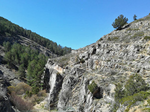
The Barranc de la Hoz is absolutely beautiful, at least as beautiful as the more famous Camino del Rey.
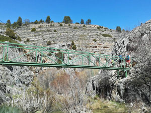
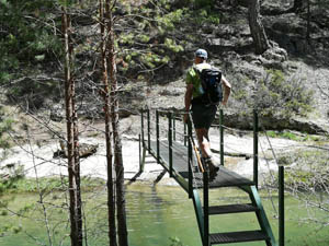
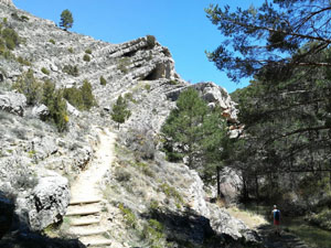
We walk along the water on well-constructed paths, bridges, stairs and elevated walkways.
The flowing water makes this really special compared to the beautiful walks on the Costa Blanca.
After the walk you can also visit the waterfalls of Calomarde.
The walk is not really difficult, at high water levels it can be a bit muddy here and there. Once we have to cross the river at a ford, for the rest there are always excellent bridges.
Spanish maps included within these descriptions are provided courtesy of the Spanish IGN and remain © Instituto Geográfico Nacional.
OSM (OpenStreetMap) and OCM (OpenCycleMap) maps are © OpenStreetMap Contributors. The OSM project welcomes contributions from all to enrich the map data, which is made freely available. Land (Thunderforest Landscape) maps are © Thunderforest based on data © OpenStreetMap contributors.
The grade of this walk is M/B, which means
M – Moderate: up to 12km in length, less than 400 metres ascent and less than 50% rough going.
B – Less than half the route on rough ground
| Nearest town | Calomarde |
| Directions to start |
From the A23 motorway running from Valencia NW past Teruel. Albarracin lies roughly NW of Teruel on the A1512 road. Continue through the town and on to Calomarde some 54km from Teruel. |
| Start point (Lat/Long) | 40.372529, -1.575356 Click here to view in Google Maps (in a new browser tab) |
| Length (km) | 11.50 |
| Ascent (metres) | 243 |
| Walking time (hours) | 2.66 |
| Total time (hours) | 4 |
| Recommendations or Restrictions | None |
Download walk descriptionDownload GPS file

Comments
Calomarde – Barranc de la Hoz — No Comments
HTML tags allowed in your comment: <a href="" title=""> <abbr title=""> <acronym title=""> <b> <blockquote cite=""> <cite> <code> <del datetime=""> <em> <i> <q cite=""> <s> <strike> <strong>