
Marnes Dos Barrancos
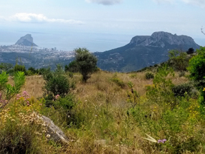
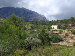
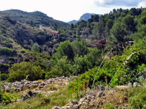
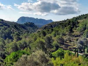
An adapted version of Charles Pye’s ‘ Tres Barrancos ‘ walk. The route goes up to Bernia campsite and from there winds round and up towards EL Cau before returning via barranco L’Aspre. Excellent views .
Spanish maps included within these descriptions are provided courtesy of the Spanish IGN and remain © Instituto Geográfico Nacional.
OSM (OpenStreetMap) and OCM (OpenCycleMap) maps are © OpenStreetMap Contributors. The OSM project welcomes contributions from all to enrich the map data, which is made freely available. Land (Thunderforest Landscape) maps are © Thunderforest based on data © OpenStreetMap contributors.
The grade of this walk is MS/B, which means
MS – Moderately Strenuous: Up to 600 metres ascent and/or no more than 15 km in length with some rough going taken at a reasonable pace.
B – Less than half the route on rough ground
| Nearest town | Benissa |
| Directions to start |
On Benissa to Bernia road (CV749), 1 km after Pinos restauarant take RH junction (Marnes) just over a bridge. After 200 mtrs park on LHS laybye |
| Start point (Lat/Long) | 38.678210, -0.017260 Click here to view in Google Maps (in a new browser tab) |
| Length (km) | 12.50 |
| Ascent (metres) | 500 |
| Walking time (hours) | 3.66 |
| Total time (hours) | 4.5 |
| Recommendations or Restrictions | None |
Download walk descriptionDownload GPS file
Comments
Marnes Dos Barrancos — No Comments
HTML tags allowed in your comment: <a href="" title=""> <abbr title=""> <acronym title=""> <b> <blockquote cite=""> <cite> <code> <del datetime=""> <em> <i> <q cite=""> <s> <strike> <strong>