
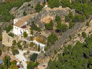
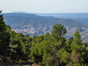
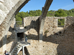
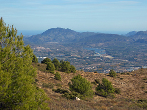
Refugio Montcabrer & Nevera from Agres
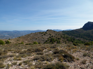
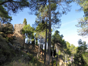
A steep climb past the Sanctuary de Agres to the refugio through pine woods before a pleasant loop with panoramic views leads to the restored Nevera. A gentler descent along a meandering forest road completes the walk with impressive vistas throughout. All on well defined paths
Spanish maps included within these descriptions are provided courtesy of the Spanish IGN and remain © Instituto Geográfico Nacional.
OSM (OpenStreetMap) and OCM (OpenCycleMap) maps are © OpenStreetMap Contributors. The OSM project welcomes contributions from all to enrich the map data, which is made freely available. Land (Thunderforest Landscape) maps are © Thunderforest based on data © OpenStreetMap contributors.
The grade of this walk is S/B, which means
S – Strenuous: More than 600 metres ascent and/or more than 15km in length with steep, loose or heavily vegetated sections.
B – Less than half the route on rough ground.
| Nearest town | Agres |
| Directions to start |
Agres town just off CV700 between Muro de Alcoy and Bocairent. Car park is just below Pension Mariola (hotel) |
| Start point (Lat/Long) | 38.780640, -0.516750 Click here to view in Google Maps (in a new browser tab) |
| Length (km) | 9.40 |
| Ascent (metres) | 700 |
| Walking time (hours) | 2.5 |
| Total time (hours) | 3.5 |
| Recommendations or Restrictions | This walk can easily be extended from the Refugio as there are many good paths. Many opt to climb Montcabra |
Download walk descriptionDownload GPS file
Comments
Refugio Montcabrer & Nevera from Agres — No Comments
HTML tags allowed in your comment: <a href="" title=""> <abbr title=""> <acronym title=""> <b> <blockquote cite=""> <cite> <code> <del datetime=""> <em> <i> <q cite=""> <s> <strike> <strong>