
Benirrama Orchid Walk
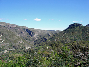
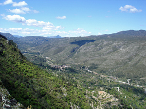
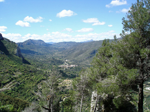
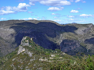
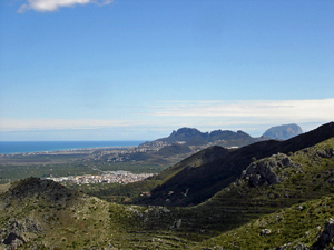
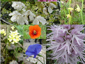
From Benirrama, a steep climb out of the valley up a zigzagging mozarabic path. The path is famous for its orchid display and cherry blossom in Springtime. A path along the ridge leads us to a more gentler descent with stunning views over the Gallinera valley.
Spanish maps included within these descriptions are provided courtesy of the Spanish IGN and remain © Instituto Geográfico Nacional.
OSM (OpenStreetMap) and OCM (OpenCycleMap) maps are © OpenStreetMap Contributors. The OSM project welcomes contributions from all to enrich the map data, which is made freely available. Land (Thunderforest Landscape) maps are © Thunderforest based on data © OpenStreetMap contributors.
The grade of this walk is M/B, which means
M – Moderate: up to 12km in length, less than 400 metres ascent and less than 50% rough going.
B – Less than half the route on rough ground
| Nearest town | Benirrama |
| Directions to start |
Take the CV700 from Pego past Adsubia and on up the Gallinera valley. Reach a turning on the L (CV170) to Benirrama. Bear R uphill as you enter the village to a parking area on the LHS. |
| Start point (Lat/Long) | 38.830462, -0.196594 Click here to view in Google Maps (in a new browser tab) |
| Length (km) | 6.30 |
| Ascent (metres) | 360 |
| Walking time (hours) | 2 |
| Total time (hours) | 3 |
| Recommendations or Restrictions | None |
Download walk descriptionDownload GPS file
Comments
Benirrama Orchid Walk — No Comments
HTML tags allowed in your comment: <a href="" title=""> <abbr title=""> <acronym title=""> <b> <blockquote cite=""> <cite> <code> <del datetime=""> <em> <i> <q cite=""> <s> <strike> <strong>