
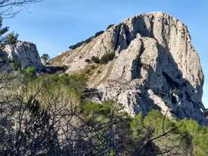
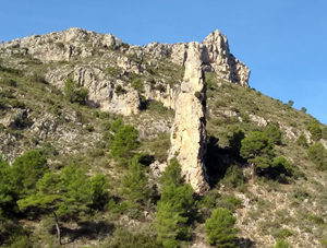
Morro Blau and Pla de Codolla circuit from Callosa
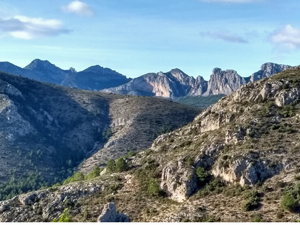
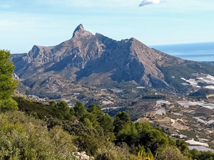
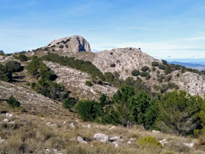
A demanding walk up a woodland path, a barranco side then up and across rocky hillside to a forest track, which takes you around to a fire watchtower then spirals down another forest path. Extensive scenic views throughout and a rewarding downhill second half.
Spanish maps included within these descriptions are provided courtesy of the Spanish IGN and remain © Instituto Geográfico Nacional.
OSM (OpenStreetMap) and OCM (OpenCycleMap) maps are © OpenStreetMap Contributors. The OSM project welcomes contributions from all to enrich the map data, which is made freely available. Land (Thunderforest Landscape) maps are © Thunderforest based on data © OpenStreetMap contributors.
The grade of this walk is VS/B, which means
VS – Very Strenuous: More than 800 metres ascent and/or more than 20km in length with steep, loose or heavily vegetated sections.
B – Less than half the route on rough ground.
| Nearest town | Callosa D’En Sarria |
| Directions to start |
From Altea direction, at main roundabout in Callosa take 2nd street on R (Avinguda Jaume 1) then R fork |
| Start point (Lat/Long) | 38.672417, -0.134233 Click here to view in Google Maps (in a new browser tab) |
| Length (km) | 12.00 |
| Ascent (metres) | 900 |
| Walking time (hours) | 4.25 |
| Total time (hours) | 5 |
| Recommendations or Restrictions | Good degree of stamina necessary as total ascent is in first 6 Kms. The route is well marked and cairned but a GPS could be useful in 2 small sections. |
Download walk descriptionDownload GPS file
Comments
Morro Blau and Pla de Codolla circuit from Callosa — No Comments
HTML tags allowed in your comment: <a href="" title=""> <abbr title=""> <acronym title=""> <b> <blockquote cite=""> <cite> <code> <del datetime=""> <em> <i> <q cite=""> <s> <strike> <strong>