
El Cantal Circuit
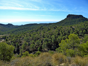
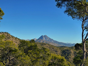
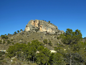
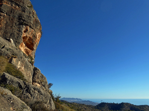
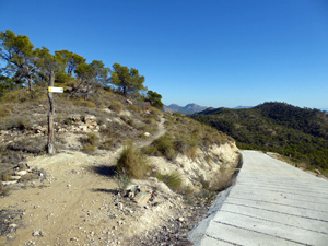
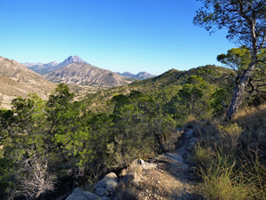
An undulating walk on mostly well defined paths and forest roads around this picturesque area visiting the impressive rocky outcrop of El Cantal. The walk offers panoramic views to the coast, to Puig Campana and to Mount Aitana.
Spanish maps included within these descriptions are provided courtesy of the Spanish IGN and remain © Instituto Geográfico Nacional.
OSM (OpenStreetMap) and OCM (OpenCycleMap) maps are © OpenStreetMap Contributors. The OSM project welcomes contributions from all to enrich the map data, which is made freely available. Land (Thunderforest Landscape) maps are © Thunderforest based on data © OpenStreetMap contributors.
The grade of this walk is MS/B, which means
MS – Moderately Strenuous: Up to 600 metres ascent and/or no more than 15 km in length with some rough going taken at a reasonable pace.
B – Less than half the route on rough ground
| Nearest town | Villajoyosa |
| Directions to start |
On N332 south of Villajoyosa near to km 132, turn North into car park next to restaurant El Charco (Closed) at grid reference Lat: 38.493310, Long: -0.287592. |
| Start point (Lat/Long) | 38.508504, -0.300893 Click here to view in Google Maps (in a new browser tab) |
| Length (km) | 13.00 |
| Ascent (metres) | 590 |
| Walking time (hours) | 3.5 |
| Total time (hours) | 5 |
| Recommendations or Restrictions | To get to the start you need to drive along a rough unpaved forest track which is unsuitable for vehicles with little ground clearance. Hire cars will not be insured on this road. There are no drinking water sources on this route. After the walk there is a roadside cafe on the right-hand side of the road about 3km further South on the N332 at Lanuza. |
Download walk descriptionDownload GPS file
Comments
El Cantal Circuit — No Comments
HTML tags allowed in your comment: <a href="" title=""> <abbr title=""> <acronym title=""> <b> <blockquote cite=""> <cite> <code> <del datetime=""> <em> <i> <q cite=""> <s> <strike> <strong>