
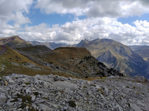
Circuit of Monte Tabazo
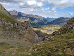
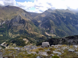
A rewarding walk with easy but steep paths in places with outstanding views across the ranges of the Pyrenees.
Spanish maps included within these descriptions are provided courtesy of the Spanish IGN and remain © Instituto Geográfico Nacional.
OSM (OpenStreetMap) and OCM (OpenCycleMap) maps are © OpenStreetMap Contributors. The OSM project welcomes contributions from all to enrich the map data, which is made freely available. Land (Thunderforest Landscape) maps are © Thunderforest based on data © OpenStreetMap contributors.
The grade of this walk is MS/B/Scr, which means
MS – Moderately Strenuous: Up to 600 metres ascent and/or no more than 15 km in length with some rough going taken at a reasonable pace.
B – Less than half the route on rough ground
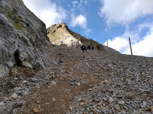
Scr – Scrambling: This implies the need for handholds to ascend steep rock pitches with a sense of exposure to vertigo and where a slip could lead to a serious accident.
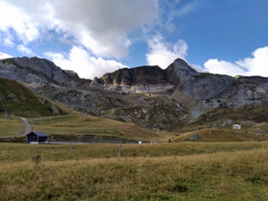
| Nearest town | Candanchu |
| Directions to start |
Follow the A23 N of Jaca and take care to avoid continuing ahead into the Somport tunnel. Follow signs to Candanchu and turn off the A23 L and into the ski village where the large car park is off to the L beside the guarded military zone! |
| Start point (Lat/Long) | 42.787183, -0.536963 Click here to view in Google Maps (in a new browser tab) |
| Length (km) | 9.30 |
| Ascent (metres) | 560 |
| Walking time (hours) | 2.75 |
| Total time (hours) | 4.5 |
| Recommendations or Restrictions | The ridge that starts at 3.8km is exposed and requires the use of hands. |
Download walk descriptionDownload GPS file
Comments
Circuit of Monte Tabazo — No Comments
HTML tags allowed in your comment: <a href="" title=""> <abbr title=""> <acronym title=""> <b> <blockquote cite=""> <cite> <code> <del datetime=""> <em> <i> <q cite=""> <s> <strike> <strong>