
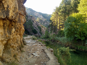
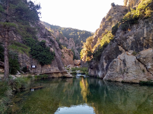
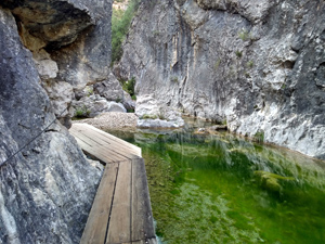
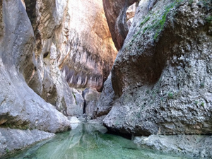
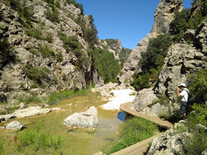
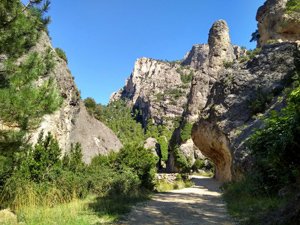
El Parrisal
A walk up beside the narrowing valley on suspended boardwalks and footpaths. Fantastic scenery
Spanish maps included within these descriptions are provided courtesy of the Spanish IGN and remain © Instituto Geográfico Nacional.
OSM (OpenStreetMap) and OCM (OpenCycleMap) maps are © OpenStreetMap Contributors. The OSM project welcomes contributions from all to enrich the map data, which is made freely available. Land (Thunderforest Landscape) maps are © Thunderforest based on data © OpenStreetMap contributors.
The grade of this walk is E/C, which means
E – Easy: A walk of up to 4½ hours on good surfaced tracks and less than 200 metres ascent.
C – More than half the route on rough ground
| Nearest town | Beceite |
| Directions to start |
Make your way to the village of Beceite and then thread carefully through the village following signs to El Parrisal to follow the partly tarmacked road running up the valley to the car park. |
| Start point (Lat/Long) | 40.797870, 0.202450 Click here to view in Google Maps (in a new browser tab) |
| Length (km) | 9.00 |
| Ascent (metres) | 100 |
| Walking time (hours) | 3 |
| Total time (hours) | 4 |
| Recommendations or Restrictions | None. Very busy in summer months. |
Comments
El Parrisal — No Comments
HTML tags allowed in your comment: <a href="" title=""> <abbr title=""> <acronym title=""> <b> <blockquote cite=""> <cite> <code> <del datetime=""> <em> <i> <q cite=""> <s> <strike> <strong>