
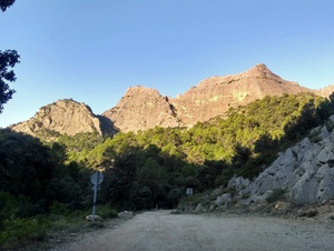
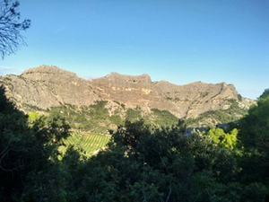
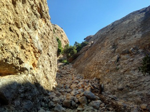
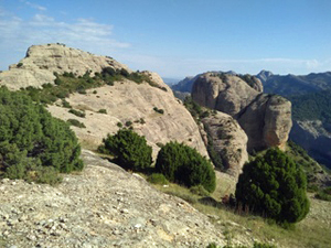
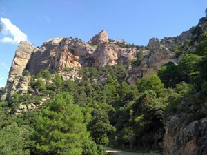
Roques de Benet from Horta de San Joan
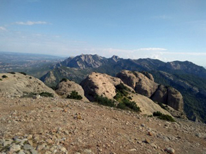
A delightful walk up through woodland with wide views of many of the Ports tops before embarking on a challenging scramble up to the summit of the Roques from where there are frequent sightings of vultures and goats along with spectacular views.
Spanish maps included within these descriptions are provided courtesy of the Spanish IGN and remain © Instituto Geográfico Nacional.
OSM (OpenStreetMap) and OCM (OpenCycleMap) maps are © OpenStreetMap Contributors. The OSM project welcomes contributions from all to enrich the map data, which is made freely available. Land (Thunderforest Landscape) maps are © Thunderforest based on data © OpenStreetMap contributors.
The grade of this walk is MS/B/Scr, which means
MS – Moderately Strenuous: Up to 600 metres ascent and/or no more than 15 km in length with some rough going taken at a reasonable pace.
B – Less than half the route on rough ground
Scr – Scrambling: This implies the need for handholds to ascend steep rock pitches with a sense of exposure to vertigo and where a slip could lead to a serious accident.
| Nearest town | Horta de San Joan |
| Directions to start |
The road which runs along the top edge of the Ports crosses the border from Aragon to Catalunya. In Aragon it is the A231 but it changes to the T333 as it enters Catalunya. Either way travelling from the SW turn R just before the turning to Horta on a small tarmacked road signed to “Els Ports”. |
| Start point (Lat/Long) | 40.901150, 0.315370 Click here to view in Google Maps (in a new browser tab) |
| Length (km) | 8.50 |
| Ascent (metres) | 530 |
| Walking time (hours) | 2.75 |
| Total time (hours) | 3.75 |
| Recommendations or Restrictions | None |
Download walk descriptionDownload GPS file
Comments
Roques de Benet from Horta de San Joan — No Comments
HTML tags allowed in your comment: <a href="" title=""> <abbr title=""> <acronym title=""> <b> <blockquote cite=""> <cite> <code> <del datetime=""> <em> <i> <q cite=""> <s> <strike> <strong>