
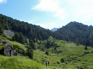
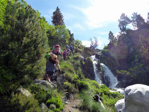
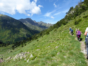
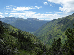
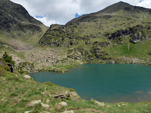
Estany Esblacat from Ordino-Arcalis
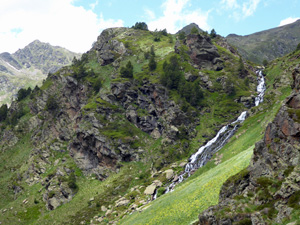
A high level (2,300 m) anticlockwise circular walk up to the Estany (lake) Esblacat, then along the valley side before descending to the car park. Spectacular views throughout.
Spanish maps included within these descriptions are provided courtesy of the Spanish IGN and remain © Instituto Geográfico Nacional.
OSM (OpenStreetMap) and OCM (OpenCycleMap) maps are © OpenStreetMap Contributors. The OSM project welcomes contributions from all to enrich the map data, which is made freely available. Land (Thunderforest Landscape) maps are © Thunderforest based on data © OpenStreetMap contributors.
The grade of this walk is MS/B, which means
MS – Moderately Strenuous: Up to 600 metres ascent and/or no more than 15 km in length with some rough going taken at a reasonable pace.
B – Less than half the route on rough ground
| Nearest town | Ordino |
| Directions to start |
From Ordino take the CS 380 (also numbered CG-3) for 15km (22 minutes) to Car park (Cs 380) at lower Ordino Arcalis ski station, near Restaurant Hortell. |
| Start point (Lat/Long) | 42.631580, 1.501100 Click here to view in Google Maps (in a new browser tab) |
| Length (km) | 6.00 |
| Ascent (metres) | 472 |
| Walking time (hours) | 2.33 |
| Total time (hours) | 3.5 |
| Recommendations or Restrictions | Off season you might not get refreshments at the end of the walk. A short drive down the valley to el Serrat there are good value bars & cafes.
The walk is quite high. Allow extra time if you are not used to altitude. |
Download walk descriptionDownload GPS file
Comments
Estany Esblacat from Ordino-Arcalis — No Comments
HTML tags allowed in your comment: <a href="" title=""> <abbr title=""> <acronym title=""> <b> <blockquote cite=""> <cite> <code> <del datetime=""> <em> <i> <q cite=""> <s> <strike> <strong>