
Aitana and Penya Mulero
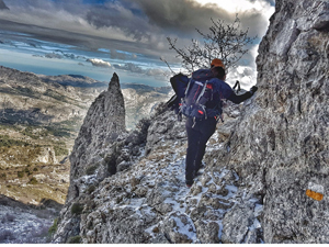
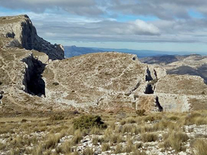
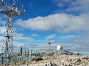
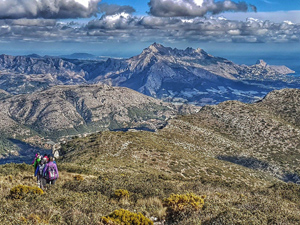
A walk on paths and tracks that takes in the ridge from the summit of Aitana along to Penya Mulero. A steep path to finally get onto the ridge which then allows for excellent views from the highest peak in the region (weather permitting).
Spanish maps included within these descriptions are provided courtesy of the Spanish IGN and remain © Instituto Geográfico Nacional.
OSM (OpenStreetMap) and OCM (OpenCycleMap) maps are © OpenStreetMap Contributors. The OSM project welcomes contributions from all to enrich the map data, which is made freely available. Land (Thunderforest Landscape) maps are © Thunderforest based on data © OpenStreetMap contributors.
The grade of this walk is VS/B, which means
VS – Very Strenuous: More than 800 metres ascent and/or more than 20km in length with steep, loose or heavily vegetated sections.
B – Less than half the route on rough ground.
| Nearest town | Benifato |
| Directions to start |
Follow the CV70 from Benidorm/Polop direction towards Guadalest/Alcoy. After Benimantell near to Km28 turn L (signed Benifato) soon after turn up 2nd RH street (sign for Fuente Partagat on wall ) continue up this steep minor road to come to the Partagas Fuente /Font. (Grid Ref: 38.657767,-0.241871, however you are advised not to use Sat Nav or Google Maps as it will take you round in circles) |
| Start point (Lat/Long) | 38.657767, -0.241871 Click here to view in Google Maps (in a new browser tab) |
| Length (km) | 12.50 |
| Ascent (metres) | 863 |
| Walking time (hours) | 3.75 |
| Total time (hours) | 5.25 |
| Recommendations or Restrictions | None |
Download walk descriptionDownload GPS file


Comments
Aitana and Penya Mulero — No Comments
HTML tags allowed in your comment: <a href="" title=""> <abbr title=""> <acronym title=""> <b> <blockquote cite=""> <cite> <code> <del datetime=""> <em> <i> <q cite=""> <s> <strike> <strong>