
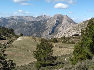
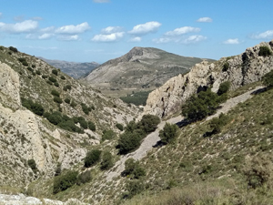
Aixorta and Cova de Cirer circuit
A tranquil walk through some picturesque rugged countryside with extensive views and a visit to an interesting cave.
Spanish maps included within these descriptions are provided courtesy of the Spanish IGN and remain © Instituto Geográfico Nacional.
OSM (OpenStreetMap) and OCM (OpenCycleMap) maps are © OpenStreetMap Contributors. The OSM project welcomes contributions from all to enrich the map data, which is made freely available. Land (Thunderforest Landscape) maps are © Thunderforest based on data © OpenStreetMap contributors.
The grade of this walk is S/C, which means
S – Strenuous: More than 600 metres ascent and/or more than 15km in length with steep, loose or heavily vegetated sections.
C – More than half the route on rough ground.
| Nearest town | Bolulla |
| Directions to start |
On CV715 Bolulla to Tarbena road, just N of Bolulla at Km 45.7 turn L up surfaced camino and continue for some distance up and park at end of surface near col below Bolulla Castle ridge. |
| Start point (Lat/Long) | 38.694100, -0.128040 Click here to view in Google Maps (in a new browser tab) |
| Length (km) | 12.50 |
| Ascent (metres) | 720 |
| Walking time (hours) | 4.25 |
| Total time (hours) | 5 |
| Recommendations or Restrictions | None |
Download walk descriptionDownload GPS file
Comments
Aixorta and Cova de Cirer circuit — No Comments
HTML tags allowed in your comment: <a href="" title=""> <abbr title=""> <acronym title=""> <b> <blockquote cite=""> <cite> <code> <del datetime=""> <em> <i> <q cite=""> <s> <strike> <strong>