
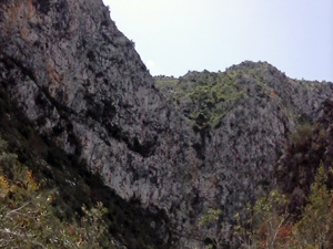
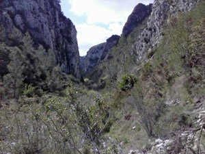
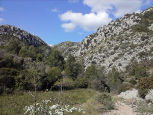
Barranco de Infierno from Pego
A demanding walk over hills and through a scramble barranco with fabulous views all day.
Spanish maps included within these descriptions are provided courtesy of the Spanish IGN and remain © Instituto Geográfico Nacional.
OSM (OpenStreetMap) and OCM (OpenCycleMap) maps are © OpenStreetMap Contributors. The OSM project welcomes contributions from all to enrich the map data, which is made freely available. Land (Thunderforest Landscape) maps are © Thunderforest based on data © OpenStreetMap contributors.
The grade of this walk is VS/B/Scr, which means
VS – Very Strenuous: More than 800 metres ascent and/or more than 20km in length with steep, loose or heavily vegetated sections.
B – Less than half the route on rough ground.
Scr – Scrambling: This implies the need for handholds to ascend steep rock pitches with a sense of exposure to vertigo and where a slip could lead to a serious accident.
| Nearest town | Pego |
| Directions to start |
Pla del Metge Almela. Approaching Pego from:–Orba on CV715 turn L after PEGO town sign (large steel pylon on corner) into wide road. Continue to Stop sign and you’re there. -El Vergel/N332 on CV700 turn R at 2nd island signed Adsubia. Straight on over two islands, L at ‘T’ junction, pass Mercadona on LHS, straight on at next island, straight on at Stop sign, R immediately after college and you’re there. |
| Start point (Lat/Long) | 38.838364, -0.121418 Click here to view in Google Maps (in a new browser tab) |
| Length (km) | 21.50 |
| Ascent (metres) | 970 |
| Walking time (hours) | 5.66 |
| Total time (hours) | 7.5 |
| Recommendations or Restrictions | For hardened walkers with some scrambling experience. |
Download walk descriptionDownload GPS file


Comments
Barranco de Infierno from Pego — No Comments
HTML tags allowed in your comment: <a href="" title=""> <abbr title=""> <acronym title=""> <b> <blockquote cite=""> <cite> <code> <del datetime=""> <em> <i> <q cite=""> <s> <strike> <strong>