
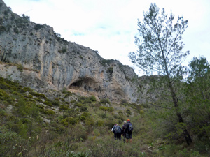
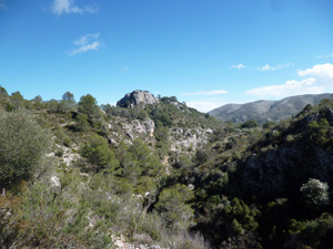
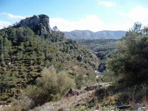
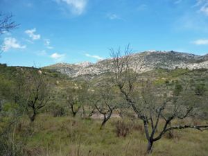
Barranco de Turrubanes
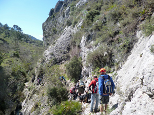
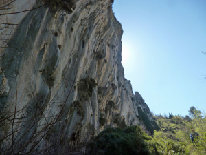
Although graded MS this is a demanding walk with some exposed scrambling near the end of the day. Nevertheless it visits some exquisite scenery in a remote barranco with fascinating rock sculptured bed.
Spanish maps included within these descriptions are provided courtesy of the Spanish IGN and remain © Instituto Geográfico Nacional.
OSM (OpenStreetMap) and OCM (OpenCycleMap) maps are © OpenStreetMap Contributors. The OSM project welcomes contributions from all to enrich the map data, which is made freely available. Land (Thunderforest Landscape) maps are © Thunderforest based on data © OpenStreetMap contributors.
The grade of this walk is MS/C/Scr/X, which means
MS – Moderately Strenuous: Up to 600 metres ascent and/or no more than 15 km in length with some rough going taken at a reasonable pace.
C – More than half the route on rough ground.
Scr – Scrambling: This implies the need for handholds to ascend steep rock pitches with a sense of exposure to vertigo and where a slip could lead to a serious accident.
X – Experienced walkers route: the route requires considerable stamina and/or significant scrambling skills on rough, steep or exposed sections.
| Nearest town | Vall d’Ebo |
| Directions to start |
From the CV 715 Orba to Pego road – SE of Pego take the CV712 to Vall d’Ebo. As you approach Vall d’Ebo go over the bridge, straight on and park at the edge of the village. |
| Start point (Lat/Long) | 38.806654, -0.157279 Click here to view in Google Maps (in a new browser tab) |
| Length (km) | 13.00 |
| Ascent (metres) | 520 |
| Walking time (hours) | 3.75 |
| Total time (hours) | 5.25 |
| Recommendations or Restrictions | Exposure, scrambling and navigation skills needed. |
Download walk descriptionDownload GPS file
Comments
Barranco de Turrubanes — No Comments
HTML tags allowed in your comment: <a href="" title=""> <abbr title=""> <acronym title=""> <b> <blockquote cite=""> <cite> <code> <del datetime=""> <em> <i> <q cite=""> <s> <strike> <strong>