
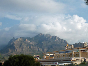
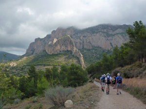
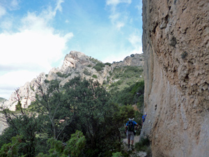
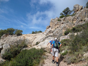
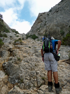
Cabeco d’Or circuit and summit
A delightful walk on this interesting mountain with an optional short scramble to the summit. Avoids a stiff ascent to Cuevas de Canalobre at the end of the walk.
Spanish maps included within these descriptions are provided courtesy of the Spanish IGN and remain © Instituto Geográfico Nacional.
OSM (OpenStreetMap) and OCM (OpenCycleMap) maps are © OpenStreetMap Contributors. The OSM project welcomes contributions from all to enrich the map data, which is made freely available. Land (Thunderforest Landscape) maps are © Thunderforest based on data © OpenStreetMap contributors.
The grade of this walk is VS/B, which means
VS – Very Strenuous: More than 800 metres ascent and/or more than 20km in length with steep, loose or heavily vegetated sections.
B – Less than half the route on rough ground.
| Nearest town | Busot |
| Directions to start |
From the A70 at junc 67 take the CV800 towards Jijona. The second turning is signed Busot. Follow the Busot signs to the roundabout at the junction of the CV773 ( approx. 6.5km on the CV773) and 774. |
| Start point (Lat/Long) | 38.506178, -0.408153 Click here to view in Google Maps (in a new browser tab) |
| Length (km) | 11.10 |
| Ascent (metres) | 840 |
| Walking time (hours) | 3.66 |
| Total time (hours) | 5.33 |
| Recommendations or Restrictions | None |
Download walk descriptionDownload GPS file

Comments
Cabeco d’Or circuit and summit — No Comments
HTML tags allowed in your comment: <a href="" title=""> <abbr title=""> <acronym title=""> <b> <blockquote cite=""> <cite> <code> <del datetime=""> <em> <i> <q cite=""> <s> <strike> <strong>