
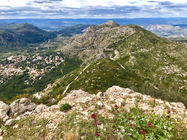
Cim del Penyalba to Cim del Monduver traverse
The fine open ridge of the Serra de Monduver, over Cim del Penyalba & Monduver, via 3 or 4 sections of scrambling, some of which is unavoidable. Visiting the Cova de les Mallaetes & Forat de la Drova. Returning via paths & tracks along a traverse of the southern flanks. Very varied terrain with fine views. Some passages are exposed & some short sections are steep & difficult!
Spanish maps included within these descriptions are provided courtesy of the Spanish IGN and remain © Instituto Geográfico Nacional.
OSM (OpenStreetMap) and OCM (OpenCycleMap) maps are © OpenStreetMap Contributors. The OSM project welcomes contributions from all to enrich the map data, which is made freely available. Land (Thunderforest Landscape) maps are © Thunderforest based on data © OpenStreetMap contributors.
The grade of this walk is VS/C/Scr/X, which means
VS – Very Strenuous: More than 800 metres ascent and/or more than 20km in length with steep, loose or heavily vegetated sections.
C – More than half the route on rough ground.
Scr – Scrambling: This implies the need for handholds to ascend steep rock pitches with a sense of exposure to vertigo and where a slip could lead to a serious accident.
X – Experienced walkers route: the route requires considerable stamina and/or significant scrambling skills on rough, steep or exposed sections.
| Nearest town | Barx |
| Directions to start |
From Gandia on CV-675 at roundabout at eastern end of village with “BARX” sign on it. Take first exit onto Carrer Pep Andres Garba and turn right immediately and right again. Pass the Ajuntament De Barx office, then turn right into car park. Which is adjacent to the roundabout. |
| Start point (Lat/Long) | 39.011100, -0.299500 Click here to view in Google Maps (in a new browser tab) |
| Length (km) | 12.50 |
| Ascent (metres) | 900 |
| Walking time (hours) | 4.25 |
| Total time (hours) | 6.5 |
| Recommendations or Restrictions | The path to the “Cova de les Mallaetes” and the summit rocks would be very slippery when wet! Navigation on the summit in thick cloud/mist, could be difficult. |
Download walk descriptionDownload GPS file


Comments
Cim del Penyalba to Cim del Monduver traverse — No Comments
HTML tags allowed in your comment: <a href="" title=""> <abbr title=""> <acronym title=""> <b> <blockquote cite=""> <cite> <code> <del datetime=""> <em> <i> <q cite=""> <s> <strike> <strong>