
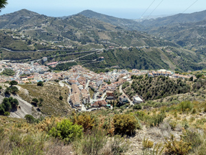
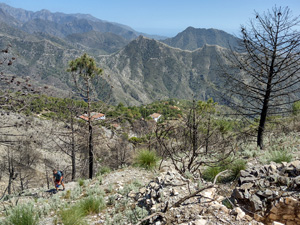
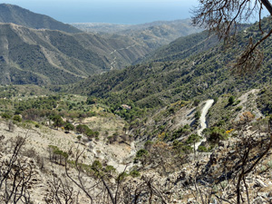
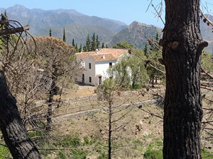
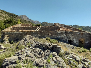
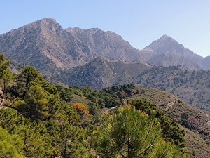
Collado de Huerte Grande, Los Pradillos and Casa de la Mina
A spectacular circuit with far reaching views to the coastline and mountains above, passing old impressive ruins of muleteers ‘ventas’/inns on a well marked route.
Spanish maps included within these descriptions are provided courtesy of the Spanish IGN and remain © Instituto Geográfico Nacional.
OSM (OpenStreetMap) and OCM (OpenCycleMap) maps are © OpenStreetMap Contributors. The OSM project welcomes contributions from all to enrich the map data, which is made freely available. Land (Thunderforest Landscape) maps are © Thunderforest based on data © OpenStreetMap contributors.
The grade of this walk is S/B, which means
S – Strenuous: More than 600 metres ascent and/or more than 15km in length with steep, loose or heavily vegetated sections.
B – Less than half the route on rough ground.
| Nearest town | Competa |
| Directions to start |
Competa lies N and inland from the coast road on the southern coast . From Torrox direction on the A7207, to Competa, at entry to village take Carril de Circunvalacion then follow sign ‘Sendero Casa de la Mina’ and Camp de Futbol and park outside stadium. |
| Start point (Lat/Long) | 36.837569, -3.970386 Click here to view in Google Maps (in a new browser tab) |
| Length (km) | 17.00 |
| Ascent (metres) | 690 |
| Walking time (hours) | 4.5 |
| Total time (hours) | 6.5 |
| Recommendations or Restrictions | None |
Download walk descriptionDownload GPS file
Comments
Collado de Huerte Grande, Los Pradillos and Casa de la Mina — No Comments
HTML tags allowed in your comment: <a href="" title=""> <abbr title=""> <acronym title=""> <b> <blockquote cite=""> <cite> <code> <del datetime=""> <em> <i> <q cite=""> <s> <strike> <strong>