
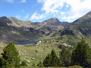
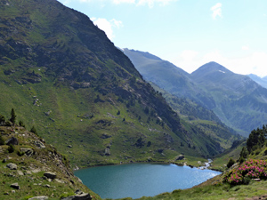
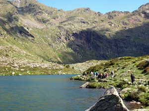
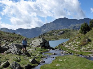
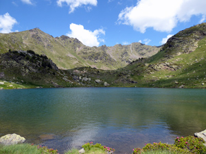
Estanys de Tristaina (Low level Circuit)
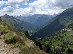
A short high level circular walk through stunning mountain and lake scenery. Lots of places to stop and picnic and admire the views. Mostly good well defined paths.
Spanish maps included within these descriptions are provided courtesy of the Spanish IGN and remain © Instituto Geográfico Nacional.
OSM (OpenStreetMap) and OCM (OpenCycleMap) maps are © OpenStreetMap Contributors. The OSM project welcomes contributions from all to enrich the map data, which is made freely available. Land (Thunderforest Landscape) maps are © Thunderforest based on data © OpenStreetMap contributors.
The grade of this walk is M/B, which means
M – Moderate: up to 12km in length, less than 400 metres ascent and less than 50% rough going.
B – Less than half the route on rough ground
| Nearest town | Ordino |
| Directions to start |
From Ordino take the CS 380 (also numbered CG-3) for 21km (34 minutes) to Car park at upper Ordino-Arcalis ski station. In high summer (July/August) you will have to ride up on cable car if road is closed at lower ski station. |
| Start point (Lat/Long) | 42.632050, 1.482030 Click here to view in Google Maps (in a new browser tab) |
| Length (km) | 4.20 |
| Ascent (metres) | 210 |
| Walking time (hours) | 1.66 |
| Total time (hours) | 2.5 |
| Recommendations or Restrictions | If cable car is in operation fare is 12 Euro.
Restaurant is normally open but more choice and cheaper prices will be found at El Sellat. The walk is quite high (2300m +). Allow extra time if you are not used to altitude. |
Download walk descriptionDownload GPS file
Comments
Estanys de Tristaina (Low level Circuit) — No Comments
HTML tags allowed in your comment: <a href="" title=""> <abbr title=""> <acronym title=""> <b> <blockquote cite=""> <cite> <code> <del datetime=""> <em> <i> <q cite=""> <s> <strike> <strong>