
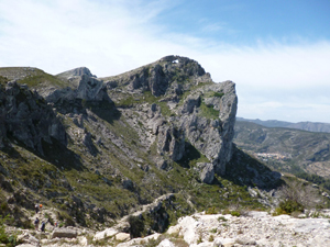
Forada ridge and circuit from Al Patro
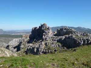
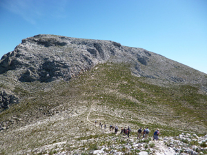
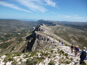
A fabulous ridge walk easily accessed by good valley roads and tracks with varied rock scenery, a castle and a Forat – a hole through the mountain!
Spanish maps included within these descriptions are provided courtesy of the Spanish IGN and remain © Instituto Geográfico Nacional.
OSM (OpenStreetMap) and OCM (OpenCycleMap) maps are © OpenStreetMap Contributors. The OSM project welcomes contributions from all to enrich the map data, which is made freely available. Land (Thunderforest Landscape) maps are © Thunderforest based on data © OpenStreetMap contributors.
The grade of this walk is S/B, which means
S – Strenuous: More than 600 metres ascent and/or more than 15km in length with steep, loose or heavily vegetated sections.
B – Less than half the route on rough ground.
| Nearest town | Al Patro |
| Directions to start |
From Pego take the CV700 westwards through the Gallinera valley to arrive in the village of Al Patro. As you leave the village there is a turning on the R signed CV714 to Llombai and Benissili. Follow this down a fw zig-zags and turn R into Carrer de Joan Fuster. Park at the side of the street. |
| Start point (Lat/Long) | 38.820476, -0.262910 Click here to view in Google Maps (in a new browser tab) |
| Length (km) | 14.00 |
| Ascent (metres) | 800 |
| Walking time (hours) | 4.00 |
| Total time (hours) | 6.00 |
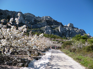
| Recommendations or Restrictions | Cherry blossom excellent during mid April |
Download walk descriptionDownload GPS file

An excellent route. We walked this last year and found an unhelpful pile of ‘garden rubbish’ at the very top of the camino rural having crossed the CV-700. This year (21 March 2017) we therefore took the more direct track leaving the camino rural at the first major hairpin, joining the published route on the traversing path leading to the fort. We particularly enjoyed the descent below the ridge taking us through beautiful blossom. Thank you for making the details available.
The garden rubbish may have been an attempt to block the path but is now easily passed on the original route.
Towards the end of the walk (10.8km,3 hours 11 min), we couldn’t find access to the path described in the notes. They seem to have been doing some sort of large earthworks on the bancales at this point which may have obscured the path. We continued down the road back to Alpatro.
Yes, it’s a shame. What started as a broad track is now a scratchy path with a couple of small land slides towards the end. It has been occasionally cut back, but the vegetation is winning. Continuing on the road and track cuts a corner and avoids a small amount of length. (But you can climb back up to rejoin the original route!)