
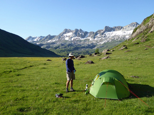
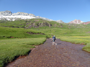
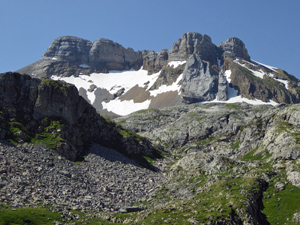
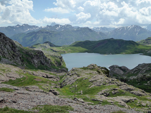
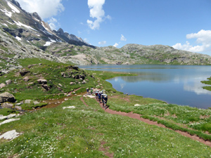
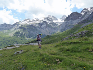
GR11 – Day 13. From a wild campsite at Aquas Tuertas to Candanchu.
A memorable walk through high mountain scenery with views in all directions.
Spanish maps included within these descriptions are provided courtesy of the Spanish IGN and remain © Instituto Geográfico Nacional.
OSM (OpenStreetMap) and OCM (OpenCycleMap) maps are © OpenStreetMap Contributors. The OSM project welcomes contributions from all to enrich the map data, which is made freely available. Land (Thunderforest Landscape) maps are © Thunderforest based on data © OpenStreetMap contributors.
The grade of this walk is S/A, which means
S – Strenuous: More than 600 metres ascent and/or more than 15km in length with steep, loose or heavily vegetated sections.
A – All good tracks.
| Nearest town | Candanchu |
| Directions to start |
This is a remote wild camp site. The nearest that you can approach by car is driving up the Vall de Hecho on the A176 and continuing through Hecho and towards La Mina. Here follow the gravel track on the S side of the river heading E until you reach a car park with a barrier. From here continue on foot uphill on the track to arrive at the bothy/refugio and drop over the hill into the meadows on the GR11. |
| Start point (Lat/Long) | 42.828628, -0.626756 Click here to view in Google Maps (in a new browser tab) |
| Length (km) | 15.50 |
| Ascent (metres) | 680 |
| Walking time (hours) | 5.00 |
| Total time (hours) | 7.00 |
| Recommendations or Restrictions | None |
Download walk descriptionDownload GPS file
Comments
GR11 – Day 13. From a wild campsite at Aquas Tuertas to Candanchu. — No Comments
HTML tags allowed in your comment: <a href="" title=""> <abbr title=""> <acronym title=""> <b> <blockquote cite=""> <cite> <code> <del datetime=""> <em> <i> <q cite=""> <s> <strike> <strong>