
GR11 – Day 18. Refugio Bujaruelo to Refugio Goriz
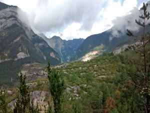
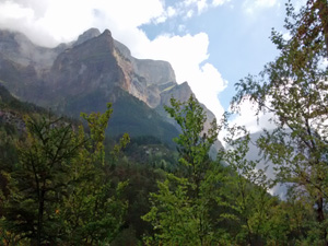
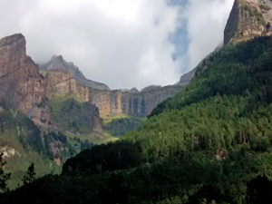
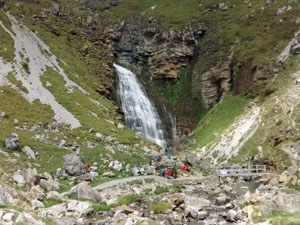
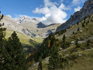
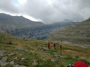
A demanding day that starts with a lengthy walk down the valley followed by an increasingly steep walk up a delightful valley culminating in steep climb up to the remote refuge.
Spanish maps included within these descriptions are provided courtesy of the Spanish IGN and remain © Instituto Geográfico Nacional.
OSM (OpenStreetMap) and OCM (OpenCycleMap) maps are © OpenStreetMap Contributors. The OSM project welcomes contributions from all to enrich the map data, which is made freely available. Land (Thunderforest Landscape) maps are © Thunderforest based on data © OpenStreetMap contributors.
The grade of this walk is VS/B, which means
VS – Very Strenuous: More than 800 metres ascent and/or more than 20km in length with steep, loose or heavily vegetated sections.
B – Less than half the route on rough ground.
| Nearest town | Torla |
| Directions to start |
Starting from Jaca in northern Spain, travel E towards Sabinanigo and then N and then E on the N260 taking care to turn off to follow it at Biescas. Follow signs to Ordessa, drive through Torla and where the road to Ordessa crosses the river to the R, look out for a turning on the L immediately after the bridge which soon becomes a gravel track following the river to the refuge of Bujaruelo where there is ample parking. |
| Start point (Lat/Long) | 42.694544, -0.106724 Click here to view in Google Maps (in a new browser tab) |
| Length (km) | 25.00 |
| Ascent (metres) | 1680 |
| Walking time (hours) | 6.50 |
| Total time (hours) | 8.50 |
| Recommendations or Restrictions | Hard and gruelling day with fantastic scenery. A world heritage site! |
Download walk descriptionDownload GPS file
Comments
GR11 – Day 18. Refugio Bujaruelo to Refugio Goriz — No Comments
HTML tags allowed in your comment: <a href="" title=""> <abbr title=""> <acronym title=""> <b> <blockquote cite=""> <cite> <code> <del datetime=""> <em> <i> <q cite=""> <s> <strike> <strong>