
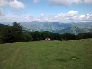
GR11 – Day 5. Elizondo to Collado de Urkiaga.
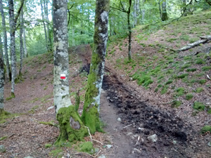
Initial climbs through deciduous woodland is rewarded by a high level ridge traverse finishing at a remote col from where transport is necessary. Several hostals in Eugi (S of the col) will provide this.
Spanish maps included within these descriptions are provided courtesy of the Spanish IGN and remain © Instituto Geográfico Nacional.
OSM (OpenStreetMap) and OCM (OpenCycleMap) maps are © OpenStreetMap Contributors. The OSM project welcomes contributions from all to enrich the map data, which is made freely available. Land (Thunderforest Landscape) maps are © Thunderforest based on data © OpenStreetMap contributors.
The grade of this walk is VS/A, which means
VS – Very Strenuous: More than 800 metres ascent and/or more than 20km in length with steep, loose or heavily vegetated sections.
A – All on good tracks
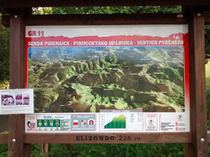
| Nearest town | Elizondo |
| Directions to start |
Find the church by walking NE up Calle Santiago and the church is on the RHS. |
| Start point (Lat/Long) | 43.145936, -1.517281 Click here to view in Google Maps (in a new browser tab) |
| Length (km) | 19.00 |
| Ascent (metres) | 1200 |
| Walking time (hours) | 5.25 |
| Total time (hours) | 6.25 |
| Recommendations or Restrictions | None |
Download walk descriptionDownload GPS file
Comments
GR11 – Day 5. Elizondo to Collado de Urkiaga. — No Comments
HTML tags allowed in your comment: <a href="" title=""> <abbr title=""> <acronym title=""> <b> <blockquote cite=""> <cite> <code> <del datetime=""> <em> <i> <q cite=""> <s> <strike> <strong>