
La Maroma – Casa de la Nieve
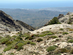
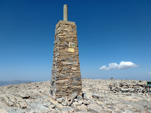
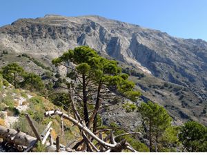
Rocky paths and Fire tracks on an exhilerating and at times remote route up to an iconic summit, the highest in the Sierra Tejeda . Spectacular 360deg.views from the ‘trig point ‘and an old Ice House.
Spanish maps included within these descriptions are provided courtesy of the Spanish IGN and remain © Instituto Geográfico Nacional.
OSM (OpenStreetMap) and OCM (OpenCycleMap) maps are © OpenStreetMap Contributors. The OSM project welcomes contributions from all to enrich the map data, which is made freely available. Land (Thunderforest Landscape) maps are © Thunderforest based on data © OpenStreetMap contributors.
The grade of this walk is VS/C, which means
VS – Very Strenuous: More than 800 metres ascent and/or more than 20km in length with steep, loose or heavily vegetated sections.
C – More than half the route on rough ground.
| Nearest town | Canillas de Aceituna |
| Directions to start |
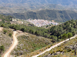
From Competa direction on MA126 arrive at outskirts of Canillas de Aceituna, at first roundabout turn R and pass large parking areas on LHS.Thread yourway through the village to arrive at the Cementeri parking. If full continue on main road to underground parking on LHS. Walk description starts from Cementeri Parking. |
| Start point (Lat/Long) | 36.874000, -4.082000 Click here to view in Google Maps (in a new browser tab) |
| Length (km) | 18.30 |
| Ascent (metres) | 1445 |
| Walking time (hours) | 5.5 |
| Total time (hours) | 7.25 |
| Recommendations or Restrictions | None |
Download walk descriptionDownload GPS file
Comments
La Maroma – Casa de la Nieve — No Comments
HTML tags allowed in your comment: <a href="" title=""> <abbr title=""> <acronym title=""> <b> <blockquote cite=""> <cite> <code> <del datetime=""> <em> <i> <q cite=""> <s> <strike> <strong>