
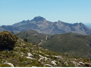
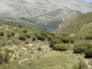
L’Encimera de Cordilleras de Almadich
A circular walk with scenic views from the high level traverse above the Almadic valley. Incorporating some original paths of ‘Dr Geoffs’
Spanish maps included within these descriptions are provided courtesy of the Spanish IGN and remain © Instituto Geográfico Nacional.
OSM (OpenStreetMap) and OCM (OpenCycleMap) maps are © OpenStreetMap Contributors. The OSM project welcomes contributions from all to enrich the map data, which is made freely available. Land (Thunderforest Landscape) maps are © Thunderforest based on data © OpenStreetMap contributors.
The grade of this walk is VS/C/Scr, which means
VS – Very Strenuous: More than 800 metres ascent and/or more than 20km in length with steep, loose or heavily vegetated sections.
C – More than half the route on rough ground.
Scr – Scrambling: This implies the need for handholds to ascend steep rock pitches with a sense of exposure to vertigo and where a slip could lead to a serious accident.
| Nearest town | Benichembla |
| Directions to start |
From CV720 Parcent to Benichembla at approx. Km. 36.8 (before Km 35) on an acute LH bend turn L beside a white wall onto a narrow surfaced road (with 10t sign) continue directly up for 200m and park near a small junction. |
| Start point (Lat/Long) | 38.748880, -0.103160 Click here to view in Google Maps (in a new browser tab) |
| Length (km) | 17.00 |
| Ascent (metres) | 840 |
| Walking time (hours) | 5.5 |
| Total time (hours) | 6.5 |
| Recommendations or Restrictions | None |
Download walk descriptionDownload GPS file
Comments
L’Encimera de Cordilleras de Almadich — No Comments
HTML tags allowed in your comment: <a href="" title=""> <abbr title=""> <acronym title=""> <b> <blockquote cite=""> <cite> <code> <del datetime=""> <em> <i> <q cite=""> <s> <strike> <strong>