
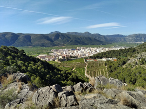
Les Creus circuit from Tavernes
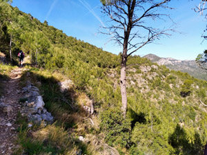
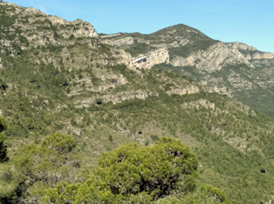
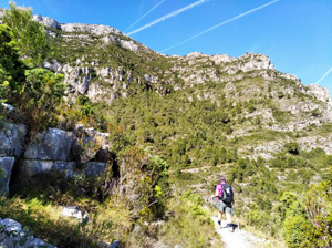
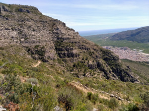
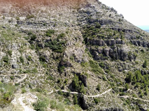
A lovely round of the initial peak of the Ratlla range with glorious coastal views in the first half and a dramatic mozarabic trail leading down to the village to finish.
Spanish maps included within these descriptions are provided courtesy of the Spanish IGN and remain © Instituto Geográfico Nacional.
OSM (OpenStreetMap) and OCM (OpenCycleMap) maps are © OpenStreetMap Contributors. The OSM project welcomes contributions from all to enrich the map data, which is made freely available. Land (Thunderforest Landscape) maps are © Thunderforest based on data © OpenStreetMap contributors.
The grade of this walk is MS/A, which means
MS – Moderately Strenuous: Up to 600 metres ascent and/or no more than 15 km in length with some rough going taken at a reasonable pace.
A – All on good tracks
| Nearest town | Tavernes de la Valldigna |
| Directions to start |
Follow the N332 N past Xeraco to reach a junction with the CV50. Follow this to a roundabout on the edge of Tavernes and turn R here to lead on to Mercadona. Turn R beyond this and park at the top of the street. |
| Start point (Lat/Long) | 39.077431, -0.261454 Click here to view in Google Maps (in a new browser tab) |
| Length (km) | 10.00 |
| Ascent (metres) | 535 |
| Walking time (hours) | 4 |
| Total time (hours) | 5 |
| Recommendations or Restrictions | One section of steep ascent before the halfway point requiring stamina and easy scrambling ability. |
Download walk descriptionDownload GPS file
Comments
Les Creus circuit from Tavernes — No Comments
HTML tags allowed in your comment: <a href="" title=""> <abbr title=""> <acronym title=""> <b> <blockquote cite=""> <cite> <code> <del datetime=""> <em> <i> <q cite=""> <s> <strike> <strong>