
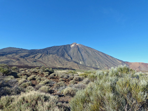
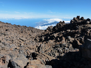
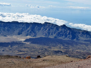
Montana Blanca to summit of Teide
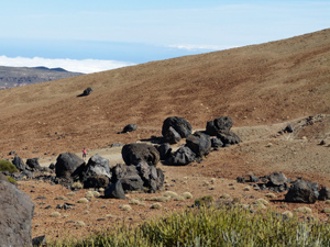
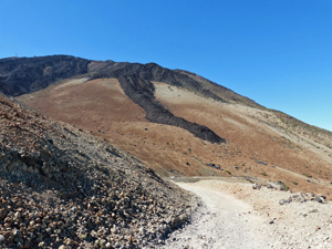
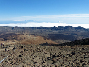
Possibly the easiest way of ascending the summit of Teide on foot without resource to artificial aids! (cable car). Stupendous mountain scenery reminding us of the power of nature.
Spanish maps included within these descriptions are provided courtesy of the Spanish IGN and remain © Instituto Geográfico Nacional.
OSM (OpenStreetMap) and OCM (OpenCycleMap) maps are © OpenStreetMap Contributors. The OSM project welcomes contributions from all to enrich the map data, which is made freely available. Land (Thunderforest Landscape) maps are © Thunderforest based on data © OpenStreetMap contributors.
The grade of this walk is VS/C, which means
VS – Very Strenuous: More than 800 metres ascent and/or more than 20km in length with steep, loose or heavily vegetated sections.
C – More than half the route on rough ground.
| Nearest town | Vilaflor |
| Directions to start |
From Los Cristianos take the TF28, TF51 and finally TF21 all sign posted to “Teide”. Pass the car park for the cable car and continue a few kilometers to the Montan Blanca car park on the LHS. Places are limited. |
| Start point (Lat/Long) | 28.259516, -16.603262 Click here to view in Google Maps (in a new browser tab) |
| Length (km) | 11.00 |
| Ascent (metres) | 1480 |
| Walking time (hours) | 5.50 |
| Total time (hours) | 7.00 |
| Recommendations or Restrictions | An extremely demanding walk with the possibility of altitude sickness. |
Download walk descriptionDownload GPS file
Comments
Montana Blanca to summit of Teide — No Comments
HTML tags allowed in your comment: <a href="" title=""> <abbr title=""> <acronym title=""> <b> <blockquote cite=""> <cite> <code> <del datetime=""> <em> <i> <q cite=""> <s> <strike> <strong>